

It was a warm day across the county with 70s and 80s for the coast, valleys and deserts and 50s, 60s and 70s in the mountains. Tomorrow will be slightly warmer for the coast and valleys as Santa Ana winds pick up slightly.
The inland and mountain communities can expect easterly winds of 20 to 45mph, locally higher in the wind-prone areas on Saturday. Lighter winds Sunday into Monday morning while the sea-breeze will return at times along the coast, bringing the potential for patchy dense fog. The best chance of fog formation will be in the morning and evening hours.
High pressure over the west, coupled with weak to mild Santa Ana winds, will keep temperatures 5 to 17degrees above average through Monday. That takes us into the 70s and 80s for most of the county and 60s for most mountains.
There will be quite a spread in morning low temperatures. Most of us will wake up in the 40s each morning, with 30s for the coldest neighborhoods, while most coastal communities will see 50s.
These warm conditions last straight into early next week, though a cooling trend begins Monday, with greater cooling by the end of the week. You can expect cooler temperatures by the end of next week with 60s for most coast and valleys, 50s in the mountains, but still in the 70s in the deserts.
We're tracking a storm that could bring rain a chance of rain at the end of next week, but there remains uncertainty on where this storm will actually track so stay with the Pinpoint Weather Team as we track this weather pattern shift.
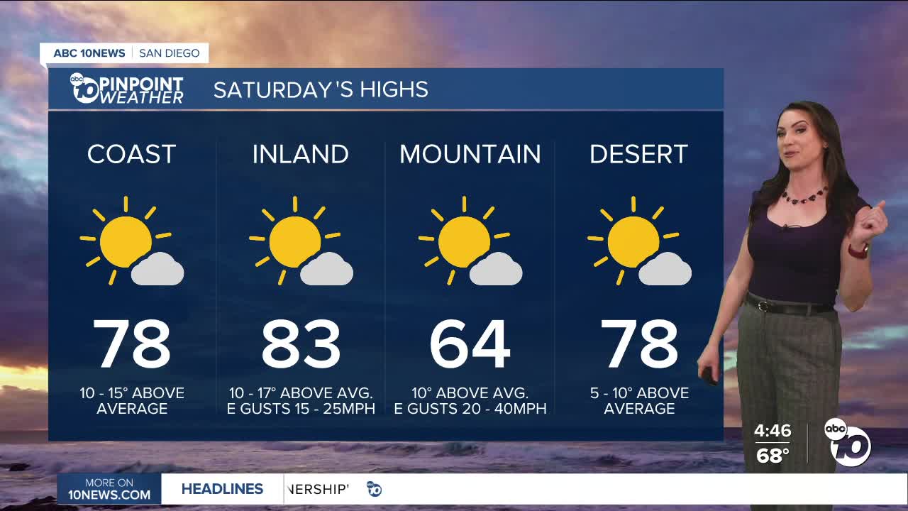
Saturday's Highs:
Coast: 72-81°
Inland: 80-86°
Mountains: 55-74°
Deserts: 78-80°
Follow ABC 10News Meteorologist Megan Parry on Facebook at Megan Parry 10News, Instagram @mis_meg_wx and Twitter @10NewsParry.
