

It was another breezy to gusty dry day across the county, with the strongest wind gust of 72mph clocked at Sill Hill, southwest of Julian, while many areas saw gusts over 20mph. The worst of the Santa Ana winds has ended, but it will remain dry and breezy all week.
Inland to the mountains, you can expect east and northeasterly winds of 25 to 50mph and humidity levels between 10 and 20%.
This long-duration Santa Ana wind event lasts through the weekend, with the potential for stronger winds late Friday into the weekend. Luckily, recent rain will help mitigate critical fire danger; however, these dry conditions are drying out the fuel, so fire danger remains elevated. Be sure to be fire safe.
The days will be getting warmer this week as high pressure builds over the west. Temperatures will trend 5 to locally 15 degrees above average with 70s for most of the county, 80s for most inland neighborhoods by Wednesday and 60s in the mountains.
The nights and morning will remain quite cool, but not as cold as the weekend. Most neighborhoods will wake up in the 40s each morning with 30s for the colder inland and mountain neighborhoods and possibly the Oceanside Airport.
These warm conditions last straight into early next week, and no significant rain is in sight.
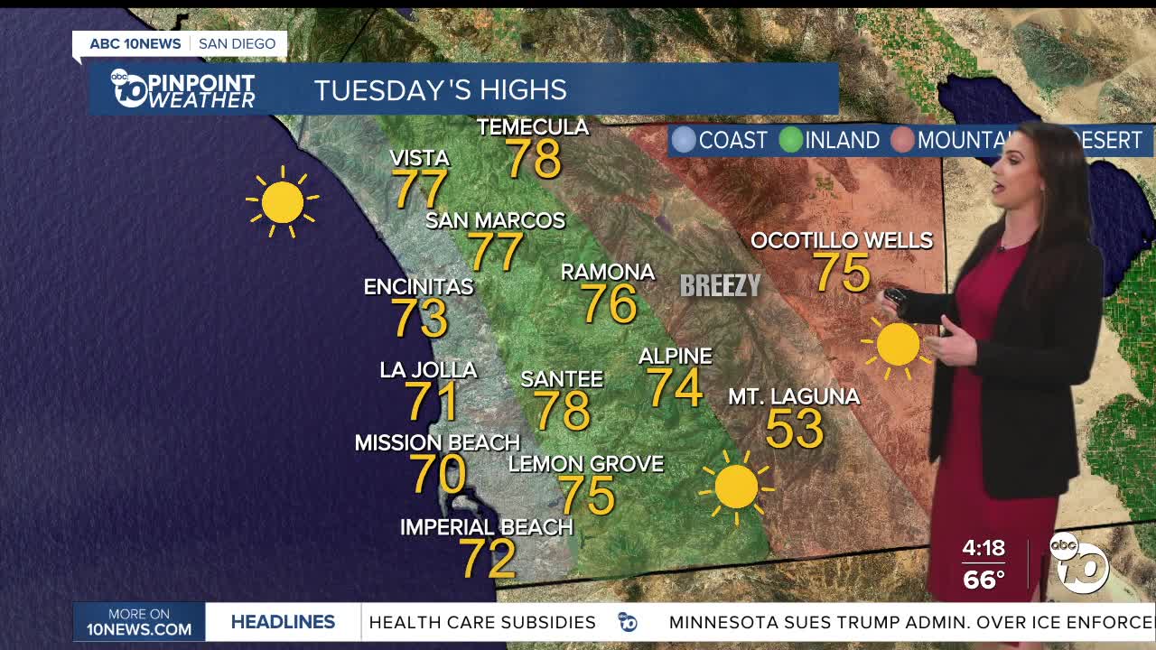
Tuesday's Highs:
Coast: 69-77°
Inland: 75-80°
Mountains: 53-70°
Deserts: 74-76°
Follow ABC 10News Meteorologist Megan Parry on Facebook at Megan Parry 10News, Instagram @mis_meg_wx and Twitter @10NewsParry.
