

Today was another warm day across the county with 70s and 80s for nearly everyone. A pattern shift is headed our way as we head deeper into February with a series of storms bringing several chances of rain.
Tuesday will be cooler and cloudier as a storm approaches, which will pass to the north of us. While there is a slight chance of sprinkles to a stray shower during the day, Tuesday will mostly be dry. The chance of isolated showers increases by the evening, with the rain becoming more scattered for the Wednesday morning commute, likely leading to a slow drive.
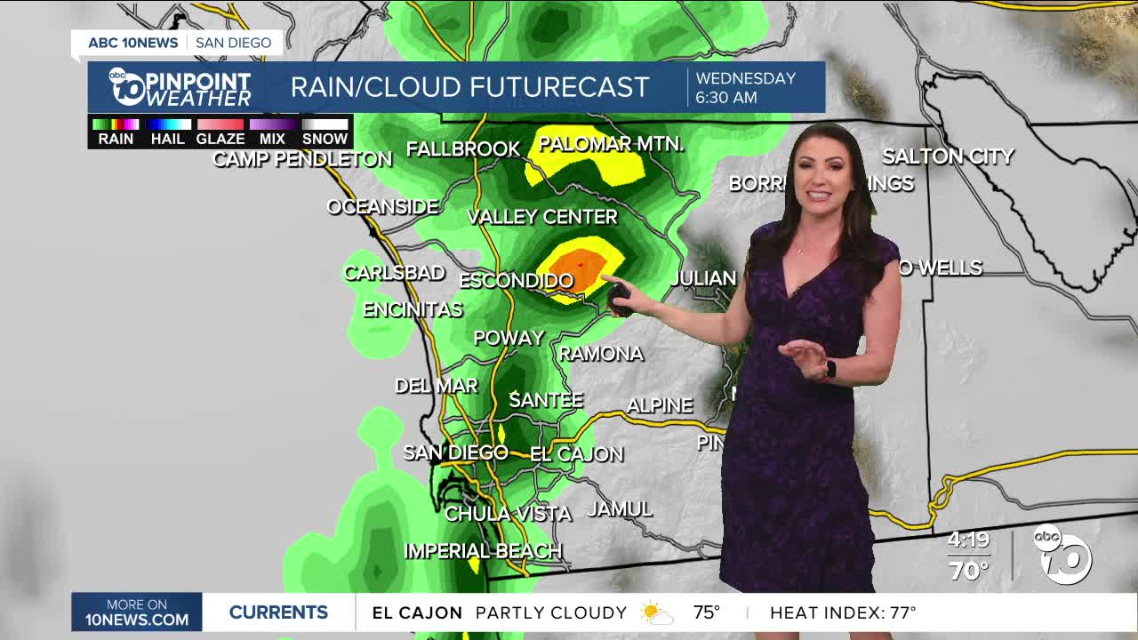
The best chance of rain is Wednesday morning, with only a slight chance of any showers in the afternoon and evening.
Rain will mostly be light to moderate, with accumulations of 0.10 to 0.25 inches, locally up to half an inch from the coast to the mountains, with little to no measurable rain in the deserts.
Gusty winds will target the mountains and deserts with southwest and westerly winds of 25 to 50mph late Tuesday into Wednesday. The coast and valleys may see gusts of 15 to 25mph.
A second storm will pass south of San Diego, bringing only a slight chance of a few showers on Thursday.
Drier with sunshine returning Friday and Saturday before a potentially larger storm arrives late Sunday into Monday. There is a potential for another storm by mid to late next week as well.
Tuesday's Highs:
Coast: 63-69°
Inland: 68-73°
Mountains: 56-69°
Deserts: 80-82°
Follow ABC 10News Meteorologist Megan Parry on Facebook at Megan Parry 10News, Instagram @mis_meg_wx and Twitter @10NewsParry.
