

It was cooler today, with temperatures near average across most of the county, in the 60s and 70s.
A storm will pass south of San Diego tonight into Saturday morning, bringing more clouds and a slight chance of patchy drizzle. Little to no accumulation is expected.
Clouds quickly clear with sunny skies and a warm-up for the weekend as winds turn back offshore.
Weak Santa Ana winds this weekend will bring northeasterly winds of 20 to 40mph to the inland and mountain communities.
A High Surf Advisory is in effect at the beaches until 6am Sunday for waves of 5 to 8 feet and sets to 10 feet, strong rip currents and possible tidal overflow and beach erosion.
Saturday temperatures will be near to 10 degrees above average, becoming warmer on Sunday, with highs soaring 10 to 15 degrees above average! On Sunday, you can expect highs in the 70s along the coast, upper 70s to low-80s inland, 60s in the mountains, and 80s in the deserts.
Much cooler by Tuesday, when temperatures will trend back near average. Expect 60s for the coast and valleys, 50s and 40s in the mountains and 70s in the deserts.
A storm will bring a chance of showers Tuesday through Friday next week, though the exact timing is uncertain. As of now Tuesday looks to be the best chance of scattered mostly light showers, with isolated showers into Wednesday then a slight chance of showers Thursday and Friday.
We'll continue to track this pattern shift and a return to winter weather and keep you updated.
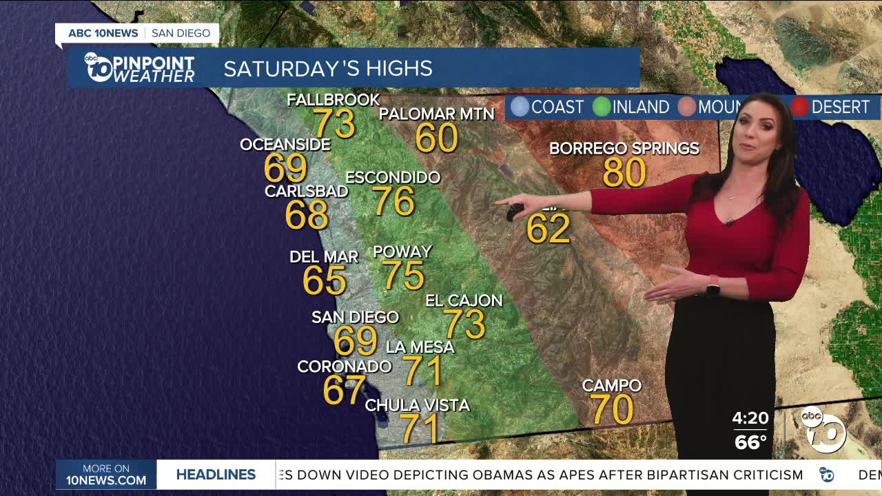
Saturday's Highs:
Coast: 67-72°
Inland: 70-76°
Mountains: 58-70°
Deserts: 80-83°
Follow ABC 10News Meteorologist Megan Parry on Facebook at Megan Parry 10News, Instagram @mis_meg_wx and Twitter @10NewsParry.
