

It was a record hot day in the deserts today, with Borrego Springs setting a record high of 94 degrees! Ocotillo Wells soared to 97 degrees, just one degree shy of the warmest spot in the country!
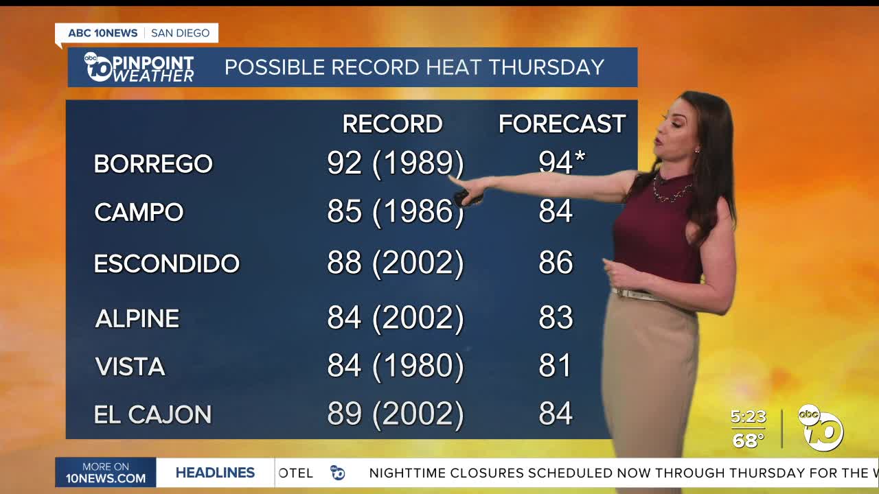
Thursday will be slightly warmer with highs soaring 10 to 20 degrees above average. I'm forecasting a record high in Borrego Springs again, while several cities will be close to records, including Campo, Escondido, Alpine, and Vista. The heat peas Friday, locally up to 25 degrees above normal with several more record highs within reach.
Fog will develop from the coast to about 10 miles inland into Thursday morning, with patchy fog possible each morning through Saturday.
It will be breezy in the mountains and deserts in the afternoons with westerly winds of 15 to 30mph.
Warm weather will be the trend this week as high pressure anchors over the Southwest. That will also keep the storm track well to the north of San Diego.
A storm stalled over the Pacific will eventually push into California next week. The timing is uncertain as the storm becomes separated from the jet stream, the main weather mover of the world, and thus more difficult to forecast. At this point, it doesn't look likely to see rain, but if the storm dives far enough south, we may be able to squeeze out some showers.
There is a second storm that may bring another chance of rain the following weekend.
Next week will be cooler, back near average for the coast and valleys by Monday, while still 5 to 10 degrees above normal in the mountains and deserts. Next week we'll see 60s and 70s for most of the county and 80s in the deserts.
Thursday's Highs:
Coast: 70-80°
Inland: 81-86°
Mountains: 69-84°
Deserts: 93-97°
Follow ABC 10News Meteorologist Megan Parry on Facebook at Megan Parry 10News, Instagram @mis_meg_wx and Twitter @10NewsParry.
