

Rain affected much of the county early this morning, resulting in a messy commute for some. Most areas received a few hundredths to 0.25 inches, with isolated areas receiving more than 0.5 inches. Most of the rain has moved out with a drier day on tap Thursday.
Click here to see rainfall totals where you live.
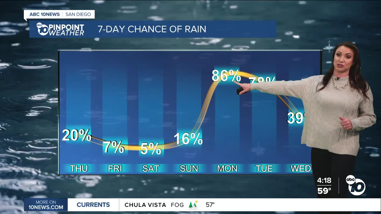
A second storm will pass south of San Diego late Thursday into Friday, keeping clouds streaming across the county and a slight chance of showers on Friday, with the best chance near the mountains.
Drier with sunshine returning Saturday for Valentine's Day and warmer temperatures, in the 60s for the coast, upper-60s to low-70s inland, 50s in the mountains, and 70s in the deserts.
A colder and stronger storm will bring more impactful rain starting Monday. There is a slight chance of showers late Sunday with rain becoming widespread, steady and heavy at times on Monday. Rain continues through Tuesday, a slight chance of showers on Wednesday, with another impactful storm on Thursday.
Flooding will be a threat next week and if you live in an area that has flood in the past, you should get sandbags ready and this weekend lift any valuables off the ground. During today's rain, if you noticed you need new tires or windshield wipers, now is the time to get those. Also, check your roof for leaks and clear gutters if needed.
More chances of rain as we continue further into February with several inches of rain expected.
Thursday's Highs:
Coast: 62-66°
Inland: 63-68°
Mountains: 52-65°
Deserts: 74-76°
Follow ABC 10News Meteorologist Megan Parry on Facebook at Megan Parry 10News, Instagram @mis_meg_wx and Twitter @10NewsParry.
