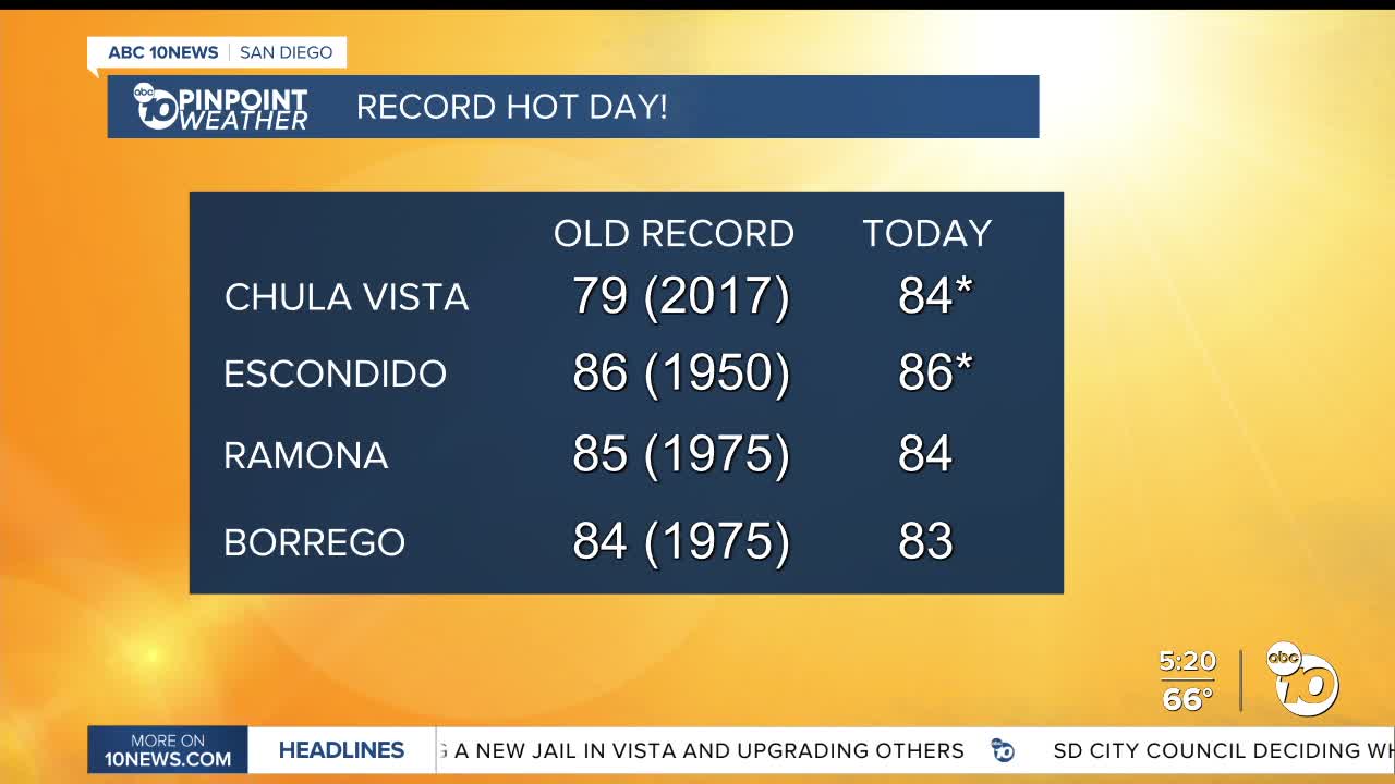


It certainly doesn't feel like December! It was a record hot day with a daily record high set in Chula Vista (84°) and tied in Escondido (86°), while Borrego Springs and Ramona were shy of their daily record highs by just one degree.
I'm forecasting record highs on Wednesday in Ramona (86°), Escondido (87°), and Chula Vista (79°), while we may be a degree or two shy in El Cajon, Palomar Mountain, and Alpine.
These temperatures are 10 to 20 degrees above average! High pressure is keeping the storm track to the north and helping fuel this record heat while weak Santa Ana winds are helping bump temperatures up and humidity down.
While we cool slightly by the weekend, temperatures will remain up to 15 degrees above average. This weekend you can expect highs in the mid-60s to low-70s at the coast, which isn't too far from what is typical for mid-December, but inland areas will be in the mid-70s, mid-60s in the mountains and upper-70s in the desert.
Winds will be weakly offshore through Thursday, continuing the very dry conditions. The marine layer starts to return Thursday night into Friday morning, when we may see patchy dense fog, especially near the coast. Patchy fog may impact the Friday morning commute with low clouds and fog spreading farther inland into the weekend.
Above normal temperatures and mostly sunny skies will be the trend into early next week as the storm track remains well to the north.
Wednesday's Highs:
Coast: 72-82°
Inland: 81-87°
Mountains: 64-80°
Deserts: 80-82°
Follow ABC 10News Meteorologist Megan Parry on Facebook at Megan Parry 10News, Instagram @mis_meg_wx and Twitter @10NewsParry.
