

It's in the headline of the article but I'll say it again — it's going to be how warm this week?!
Temperatures are trending about 10-20 degrees above normal at times this week, with some spots set to tie or break records.
It started on Monday, with everyone climbing about 5-15 degrees above normal. Those daytime highs hit their peak on the coast and in the inland valleys on Tuesday.
The coast will range around mid-70s to mid-80s, with the valleys hitting the upper 70s to upper 80s.
In fact, Chula Vista could tie a record with a forecast of 79 degrees Tuesday.
Just one day later, Ramona (85), Lake Cuyamaca (69) and Borrego (84) could tie or break records. All three could do it again the following day as well.
Thursday is when the mountains and deserts hit their high point, ranging about 15-20 degrees warmer than normal.
Those temperatures start to settle into the weekend, cooling off by about 5-10 degrees from their peak during the week, but everyone will still be above average through Sunday.
Monday also brought Santa Ana winds to the mountains and valleys, with the strongest afternoon gusts clocking in around 30-35 mph. Those winds will remain gusty at times overnight, settle Tuesday morning before picking back up a bit Tuesday afternoon.
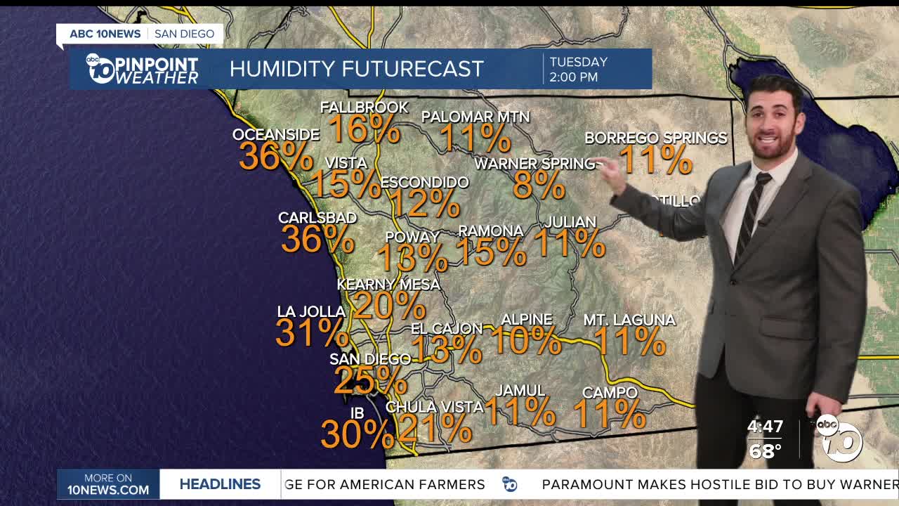
In that window, minimum relative humidity will continue to drop, with most areas on Tuesday falling between 10-15%, and some select spots like Warner Springs dropping into the single digits.
Those Santa Ana winds appear to take a break Wednesday and Thursday, but could be back by Friday.
On top of ALL that, expect mostly sunny to clear conditions all week long.
Tuesday's Highs:
Coast: 74-84°
Inland: 78-88°
Mountains: 62-77°
Deserts: 75-80°
Follow ABC 10News Weather Anchor Max Goldwasser on Instagram, Facebook and Twitter.
