

A mild finish to the first weekend in December will be followed by gusty Santa Ana winds and the potential for record high temps next week.
Saturday will wrap up with patchy fog on the coast, with a breeze hitting the mountains where the strongest gusts overnight will his 30 mph.
Sunday will start on a similar note, to go along with mostly sunny skies across the county.
The coast will see a light cloud cover gradually work back into the area throughout the afternoon and into the evening.
Temperatures on Sunday will top out between 2-15 degrees above average, with the highest departure from normal coming in the mountains.
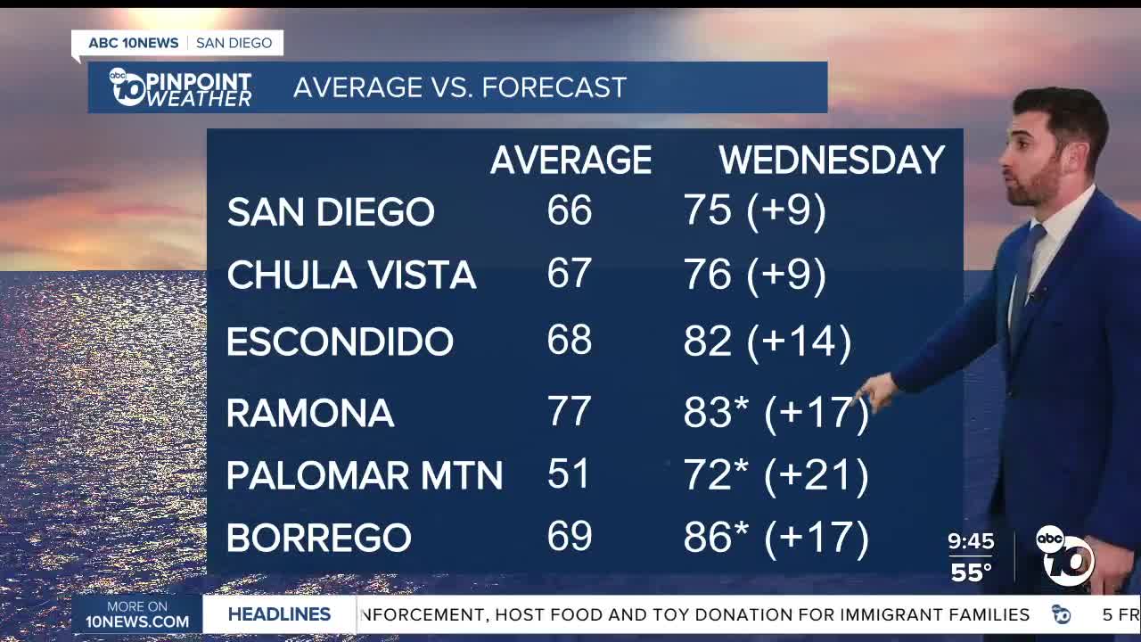
Those temps are only going to climb during the week, hitting their high point Tuesday-Thursday.
Ramona (85), Palomar Mountain (72) and Borrego (84) could all tie records on Tuesday, and either tie or set records on Wednesday. Ramona has the potential to see that continue through Thursday, and Borrego through Saturday.
Everyone will be about 10-20 degrees above average in that span.
Santa Ana winds will hit the mountains and valleys Monday and Tuesday as well, with peak gusts ranging between 35-45 mph. Those winds come with drier conditions as well, with minimum relative humidity expected to fall between 15-20% each afternoon.
Sunday's Highs:
Coast: 65-72°
Inland: 72-78°
Mountains: 57-72°
Deserts: 71-76°
Follow ABC 10News Weather Anchor Max Goldwasser on Instagram, Facebook and Twitter.
