

It was a warm and windy day in parts of the county with gusty Santa Ana winds continuing, not as strong as Monday, but still strong in some areas. Peak wind gusts to date included Hellhole Canyon at 61mph and Sill Hill, which had gusts over 70mph on Monday and Tuesday, peaking at 55mph. Even Poway and Imperial Beach saw gusts over 30mph.
These Santa Ana winds helped bump temperatures into the 70s for nearly the entire county. That is 5 to 15 degrees above normal for the coast and valleys. Santa Ana winds will continue into Wednesday morning but will generally be less than 45mph.
This first storm is going to be a warm one as subtropical moisture is getting pulled in from the South Pacific. Though it will be cooler than Tuesday, temperatures will be in the 60s for most of the county with a few highs in the low-70s inland. The high temperature for Wednesday will be reached in the morning, cooling when the rolls in by the afternoon.
It will be cooler the rest of the week with temperatures trending near to slightly below average by Thursday/New Year's Day.
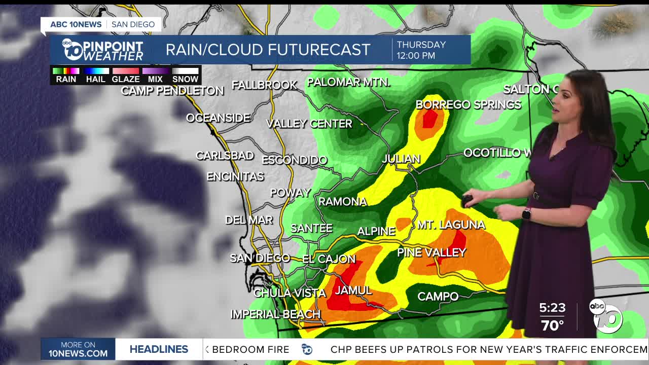
The first storm of the week will be the most impactful, bringing widespread rain from Wednesday afternoon/New Year's Eve into Thursday morning. A few showers will be possible by Wednesday morning, with the most widespread rain Wednesday afternoon into the evening, while the heaviest rain will be more isolated overnight Wednesday into Thursday morning.
Shower activity will taper off by mid-afternoon into the evening on New Year's Day.
Storm one totals will average between .50 to 1.50" for most of the county, locally up to 2" for the coast and valleys, and locally to 3" in the mountains, while the deserts will pick up less than .50". The highest totals are expected in the north county. Localized flooding and ponding on roadways will be a concern.
A slight chance of showers on Friday as we are in between storms. Storm two will bring scattered showers Saturday and Sunday. This storm will be less impactful than the New Year's Eve storm.
Storm two totals will be lighter, likely between .15 to .50" for most of the county.
Slight chance of showers on Monday before yet another storm brings another round of wet weather late Tuesday into Wednesday. But wait, there's more! There are several more chances of rain heading through mid-January. Have a happy and safe New Year!
Wednesday's Highs:
Coast: 65-69°
Inland: 65-71°
Mountains: 48-62°
Deserts: 64-67°
Follow ABC 10News Meteorologist Megan Parry on Facebook at Megan Parry 10News, Instagram @mis_meg_wx and Twitter @10NewsParry.
