

The marine layer quickly rolled in this evening, enhanced by a storm digging south along the west. Those clouds may produce misty conditions to patchy drizzle overnight into Wednesday morning.
Gusty winds will target the mountains and deserts Tuesday night into Wednesday afternoon with westerly gusts of 25 to 40mph. The wind turns back offshore with gusty Santa Ana winds targeting the inland, foothill, and mountain communities Wednesday evening through Friday, peaking Thursday morning.
You can expect easterly winds of 25 to 40mph, with isolated gusts to 55mph in wind-prone areas. Humidity will also drop between 10 and 25%, but recent rain and the green-up happening across the county will help mitigate the fire danger.
The last super moon of the year happens this Thursday, and viewing should be ideal across the county! This super moon will bring King Tides to the coast with a Beach Hazards Statement in effect from 10pm Tuesday until 10am Friday. Expect waves of 4 to 6 feet, strong rip currents, and possible tidal overflow during the highest high tide, which is at 6:53am Wednesday at 6.8', 7:34am Thursday at 7.1', and 8:18am Friday at 7.1'. Areas that may flood would be boardwalks, side streets near the beach, and beach parking lots.
Minor warming into the weekend when we'll see mid-60s to low-70s at the coast, low to mid-70s inland and in the deserts and mid-50s to low-60s in the mountains.
Much warmer next week as another round of Santa Ana winds is expected by Tuesday. Now is a great time to clear defensible space around your home to prepare for any future fires.
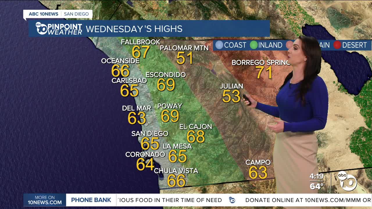
Wednesday's Highs:
Coast: 63-67°
Inland: 65-70°
Mountains: 47-63°
Deserts: 70-72°
Follow ABC 10News Meteorologist Megan Parry on Facebook at Megan Parry 10News, Instagram @mis_meg_wx and Twitter @10NewsParry.
