

Several record highs were set today as temperatures soared 10 to 20 degrees above average. Daily record highs were set or tied in Alpine (85°), Campo (83°), Ramona (85°) and Lake Cuyamaca (72°). Also notable was the morning low in Ramona of 36 degrees, which had a nearly 50-degree warm-up by the afternoon!
Click here to see daily record and average temperatures where you live.
The fog we've been experiencing all week will be patchy again into Friday morning, becoming more widespread late Friday night into Saturday morning. Areas of fog will return into Sunday morning. Be sure to check with your airline for any travel impacts due to the fog.
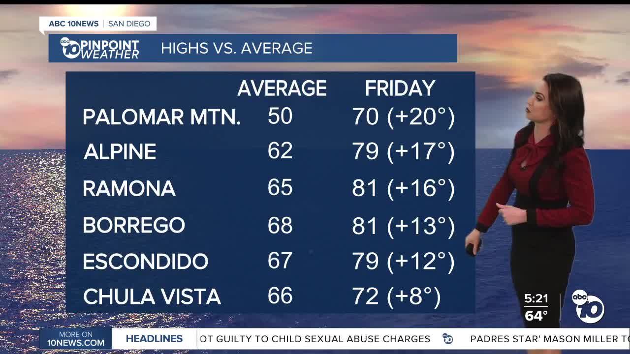
Friday will be about 5 degrees cooler for the coast and inland areas, but still 10 to 20 degrees above average for most of the county.
Temperatures cool over the weekend, but remain 5 to 15 degrees above average away from the coast, with more record highs within reach for the mountains and deserts. This weekend expect 60s and 70s.
Despite these warm temperatures, winter is coming! The winter solstice happens this Sunday at 7:03am.
A weather pattern change is coming just in time for Christmas as an atmospheric river sags south through California, bringing widespread rain to the county. A few showers are possible as early as Tuesday afternoon/evening, with a better chance of widespread and impactful rain Christmas Eve into Christmas Day. The chance of rain may linger into Friday. This is still a week out, so there remains uncertainty on the exact timing and rainfall totals.
Stay with the Pinpoint Weather Team for updates as we approach the holiday.
Friday's Highs:
Coast: 65-74°
Inland: 72-81°
Mountains: 68-81°
Deserts: 80-84°
Follow ABC 10News Meteorologist Megan Parry on Facebook at Megan Parry 10News, Instagram @mis_meg_wx and Twitter @10NewsParry.
