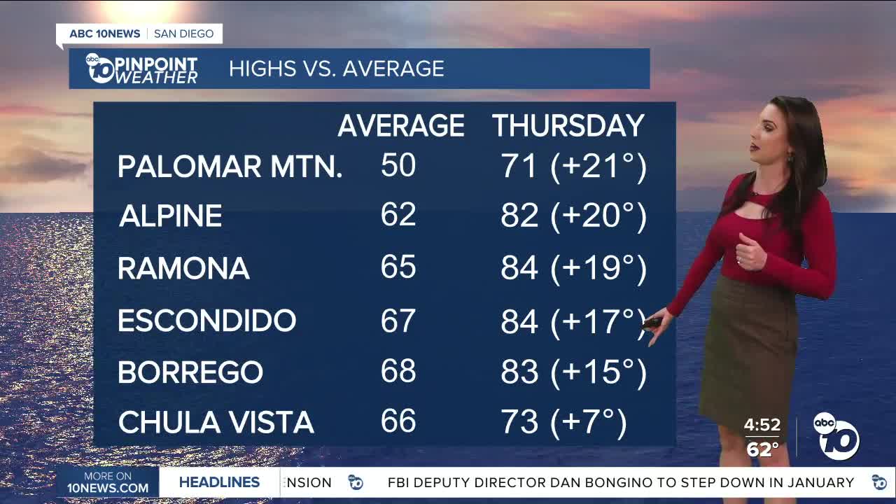


Another record high was reached today! Palomar Mountain warming to 67 degrees, ties the previous record set in 2013. Tomorrow is going to be warmer across the county as winds turn offshore, temperatures will soar 5 to 21 degrees above average, with the biggest spread away from the immediate coast.
I expect more record highs tomorrow with these warmer temperatures. I'm forecasting daily record highs in Alpine (82°), Campo (83°), and Palomar Mountain (71°) and getting really close in Escondido (84°), Ramona (84°) and Borrego Springs (83°).
Click here to see daily record and average temperatures where you live.
The fog we've been experiencing all week will be patchier into Thursday morning as winds turn back offshore and mild Santa Winds develop. That will help clear the fog and haze out but pockets of poor visibility are still possible Wednesday night into Thursday morning and again by Friday morning.
Thursday and Friday will be the warmest days of the week for most of the county, with 70s and 80s, except for a few 60s along the coast and in the mountains.
Temperatures cool over the weekend, but remain mostly 5 to 15 degrees above average away from the coast, with more record highs within reach for the mountains and deserts. This weekend expect 60s and 70s.
Despite these warm temperatures, winter is coming! The winter solstice happens this Sunday at 7:03am.
A weather pattern change is coming just in time for Christmas as an atmospheric river sags south through California, bringing widespread rain to the county. There remains uncertainty on timing and totals this far out, but a few showers may be possible as early as Tuesday afternoon/evening, with a better chance of rain Christmas Eve into Christmas Day. The chance of rain may linger into the weekend.
Thursday's Highs:
Coast: 67-78°
Inland: 75-85°
Mountains: 67-83°
Deserts: 83-85°
Follow ABC 10News Meteorologist Megan Parry on Facebook at Megan Parry 10News, Instagram @mis_meg_wx and Twitter @10NewsParry.
