

That stubborn fog is sticking around for the coast and some inland areas to start the week, but so are those warmer temperatures.
Monday will begin with low clouds and low visibility. The coast will see gradual clearing throughout the day, but skies will be partly cloudy at best while the rest of the region will enjoy clearer conditions.
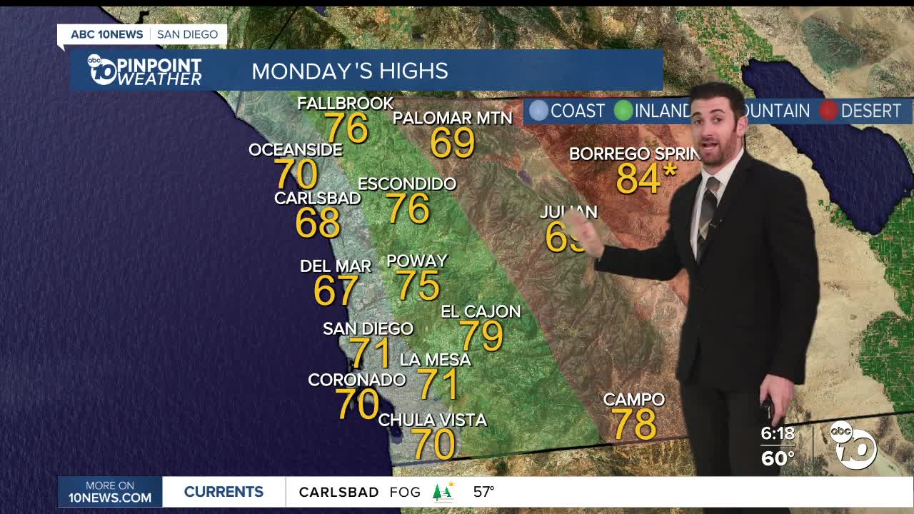
Temperatures will top out around five degrees above normal on the coast in the mid-60s to mid-70s.
Inland valleys will be about 10 degrees warmer than normal in the mid-70s to low 80s.
The mountains and deserts will see the furthest departure at about 15-20 degrees above average, in the low 60s to upper 70s and upper 70s to mid-80s, respectively.
As of today (Sunday), San Diego County has seen at least one new record high in 6 of the last 7 days. That's a trend that looks to continue!
Borrego could set a new daytime high record on Monday with a forecast of 84 degrees.
Tuesday gets even warmer, with a bump of a few degrees across the board. Palomar Mountain (71), Lake Cuyamaca (72), Campo (80) and Borrego (86) could all set new records.
Those temperatures will gradually cool down Wednesday onward, but we will still be above average the whole way. In fact, at least one area in the mountains or deserts is expected to set a new record daytime high every day through next Saturday.
If it happens, that would make it 12 of the last 13 days with a new record somewhere in the county!
Monday's Highs:
Coast: 66-74°
Inland: 74-81°
Mountains: 63-78°
Deserts: 79-84°
Follow ABC 10News Weather Anchor Max Goldwasser on Instagram, Facebook and Twitter.
