

Gusty Santa Ana winds impacted parts of the county today, with east and northeasterly gusts up to 55mph at Hellhole Canyon near Valley Center and up to 37mph in Alpine.
The sea breeze returns tomorrow and will build in the mountains and deserts by Tuesday night, where westerly gusts of 25 to 45mph will be possible.
Winds turn back offshore Wednesday through Friday with mild to moderate Santa Ana winds expected to impact the inland and mountain communities, and occasionally reach the coast.
You can expect easterly winds of 25 to 40mph, with isolated higher gusts in wind-prone areas. Humidity will also drop, but recent rain and the green-up happening across the county will help mitigate the fire danger.
The last supermoon of the year happens this Thursday and viewing should be ideal across the county! This supermoon will bring King Tides to the coast with a Beach Hazards Statement in effect from 10pm Tuesday until 10am Friday. Expect waves of 4 to 6 feet, strong rip currents, and possible tidal overflow during the highest high tide, which is at 6:53am Wednesday, 7:34am Thursday, and 8:18am Friday.
Minor warming into the weekend and early next week with mostly 60s along the coast, upper-60s to low-70s inland, and into the mid-70s by Sunday, mostly 50s in the mountains and low to mid-70s in the desert.
Another round of Santa Ana winds is possible by Tuesday next week. Now is a great time to clear defensible space around your home to prepare for future fires.
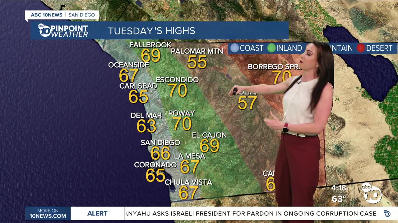
Tuesday's Highs:
Coast: 63-68°
Inland: 65-70°
Mountains: 54-67°
Deserts: 70-73°
Follow ABC 10News Meteorologist Megan Parry on Facebook at Megan Parry 10News, Instagram @mis_meg_wx and Twitter @10NewsParry.
