



Weather Headlines:
- Not as hot this week, temperatures near to 5 degrees above average
- Extreme Heat Warning in the deserts continues until 8pm Tuesday.
- Monsoon moisture builds starting Wednesday, pumping in higher humidity
- Slight chance of monsoon storms over the mountains Wednesday, Thursday and perhaps again Sunday and Monday
It will be seasonably hot this week with temperatures trending near to 5 degrees above average across the county. The Extreme Heat Warning in the mountains ends at 8pm Monday while the deserts remains in effect until 8pm Tuesday for high temperatures between 110 and 116 degrees.
The marine layer will spread from the coast into the inland valleys each morning with patchy fog possible for the morning commutes. Clouds will quickly clear to sunny skies.
Monsoon flow strengthens Wednesday with higher humidity spreading across the county, a trend that may stick around through mid to late August. Clouds will build over the mountains each afternoon and may produce a stray shower or thunderstorm. While not likely, there is a slight chance of afternoon and evening mountain storms Wednesday and Thursday and perhaps again Sunday and Monday.
With higher humidity, the nights will be a bit warmer this week. Temperatures will stay in the 70s most of the night for the coast, valleys and mountains only dipping into the 60s into the early morning hours. While the deserts will be in the 90s most of the night, only cooling into the 80s before sunrise.
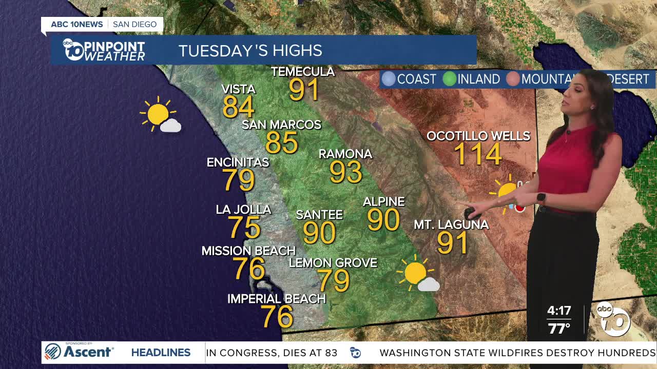
Tuesday's Highs:
Coast: 75-84°
Inland: 84-92°
Mountains: 88-98°
Deserts: 112-115°
Follow ABC 10News Meteorologist Megan Parry on Facebook at Megan Parry 10News, Instagram @mis_meg_wx and Twitter @10NewsParry.
