



Just kidding everyone!
It looks like our Heat Advisory, and Extreme Heat Warning, has been extended through Saturday.
So at least one more day of intense heat is predicted, before the alerts expire at 8 p.m.
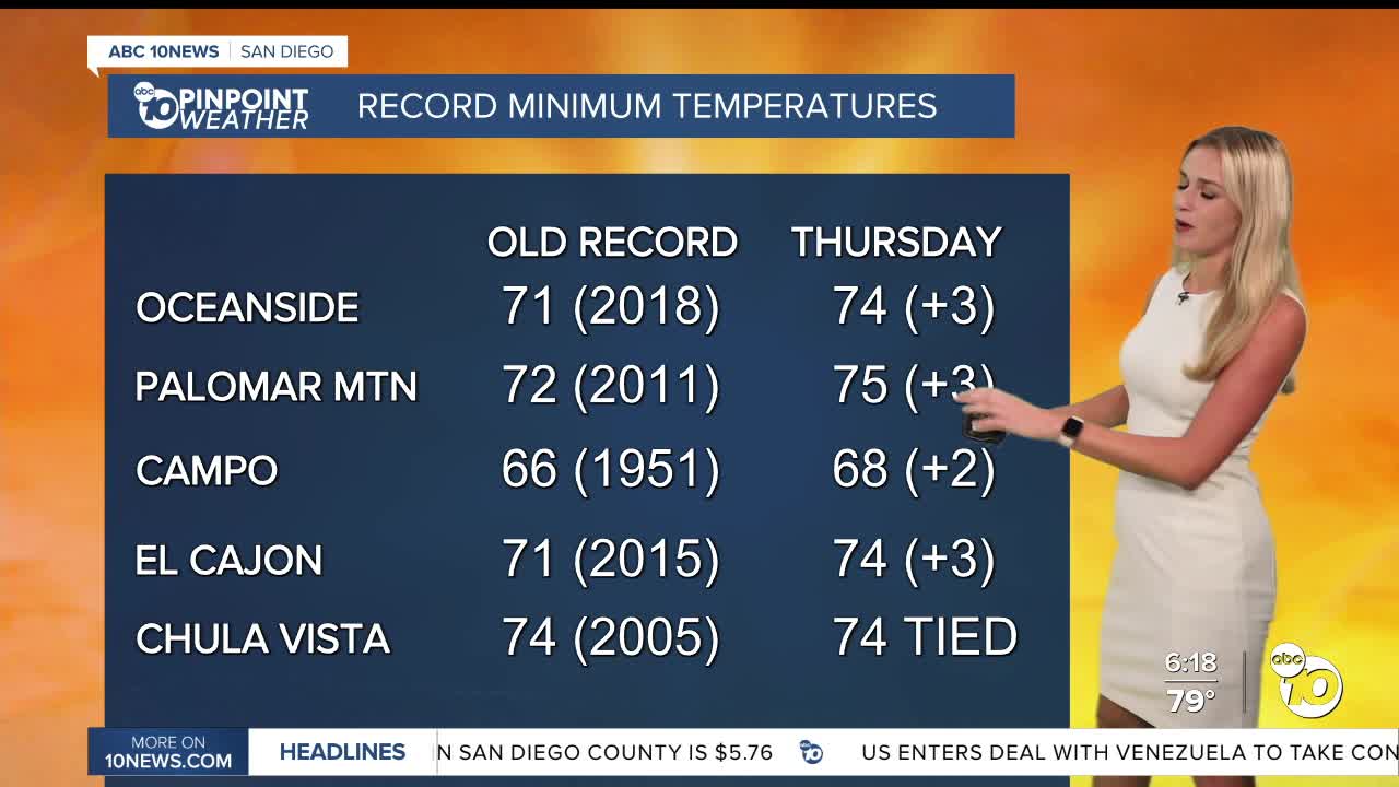
We’ve broken quite a few records for our low temperatures on Thursday.
Oceanside set a new record at 74°, Palomar Mountain at 75°, and Campo beat a record set in 1951 with a low of 68°.
For a full list of records broken, click here.
Friday, we saw some spots get even warmer than Thursday thanks to a lack of cloud cover.
We also saw the deserts pick up some thunderstorms, as well as a brief Flood Advisory.
Looking ahead to Saturday, we will see highs in the mid to low 80s along the coast.
Heading inland? Expect highs in the mid to upper 90s to start the weekend.
Our mountains will see temperatures reach the upper 80s and low 90s.
As for our deserts, highs will be near the 110° mark.
By Sunday, we are expecting temperatures to get closer to normal.
Monday is expected to be the coolest day of the week.
Looking ahead to Tuesday and Wednesday, high clouds will increase with a 20 to 30 percent chance of light rain.
Saturday's Highs:
Coast: 80-85°
Inland: 93-98°
Mountains: 87-96°
Deserts: 108-113°
Follow ABC 10News Weather Anchor Ava Kershner on Instagram, Facebook, and X.
