

Isolated showers and thunderstorms affected the mountains and deserts today due to monsoon moisture. It was hot today with 90s for inland areas and many 80s along the coast, while temperatures were near to slightly below average in the mountains and deserts.
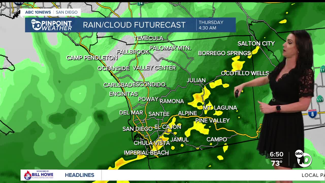
Clouds became abundant this afternoon and temperatures dropped quickly once the clouds moved in. These clouds are from Tropical Cyclone Juliette, churning west of Baja. Moisture increases Thursday making things more humid with isolated to potentially scattered showers across the county.
Rainfall totals will average between .05 to .25" and locally up to .50" with the highest totals in the southern portions of the county. The best chance of rain is in the morning and into the afternoon.
While it will be muggier tomorrow, it won't be as hot! In fact, temperatures will be below average away from the coast, with the mountains 10 to 15 degrees below average, and the deserts about 20 degrees cooler than normal! We'll see 70s and 80s everywhere in the county.
Monsoon flow weakens Friday and Saturday, so it won't be as humid, but it will be warmer and the chance for any storms in the mountains is minimal. Monsoon flow starts to rebuild Sunday, ramping up next week, bringing several more days of isolated showers and thunderstorms over the mountains and deserts.
This Labor Day weekend you can expect 70s and 80s at the coast, mostly 90s inland, 80s in the mountains and between 105 to 110 in the deserts.
Thursday's Highs:
Coast: 75-82°
Inland: 82-87°
Mountains: 70-82°
Deserts: 85-88°
Follow ABC 10News Meteorologist Megan Parry on Facebook at Megan Parry 10News, Instagram @mis_meg_wx and Twitter @10NewsParry.
