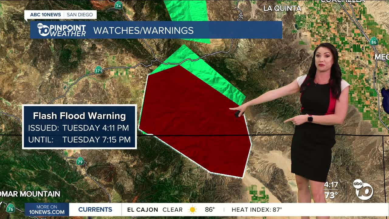


While today wasn't as active for rain and thunderstorms as the last few days, we still saw a few storms form over the mountains and deserts. In fact, there is a Flash Flood Warning in the far northeastern portion of the county, north of Borrego Springs, until 7:15pm.
On Wednesday, the monsoon flow weakens, bringing only a slight chance of showers and thunderstorms over the mountains and deserts.
Clouds will build across the county Wednesday afternoon and evening as moisture from Tropical Storm Juliette, churning southwest of Cabo, weakens and moves north. Those clouds will be more abundant Thursday and may produce showers anywhere in the county. These clouds may hinder high temperatures from warming to near average but it will be quite muggy.
Monsoon flow will ebb and flow into early next week, bringing a chance of showers and thunderstorms to the mountains and deserts at times. Friday and Saturday will be drier and it's not likely to see any storms form. Moisture and instability are expected to increase from Sunday through Tuesday, with another chance of showers and thunderstorms.
Temperatures will be near to below average through Thursday before slight warming Friday into the weekend before another dip in temperatures next week. This Labor Day weekend you can expect 70s and 80s at the coast, 80s and 90s inland, 80s in the mountains and between 105 to 110 in the deserts.
Drier by the end of next week with more comfortable humidity levels.
Wednesday's Highs:
Coast: 72-83°
Inland: 84-92°
Mountains: 77-92°
Deserts: 98-102°
Follow ABC 10News Meteorologist Megan Parry on Facebook at Megan Parry 10News, Instagram @mis_meg_wx and Twitter @10NewsParry.
