

The marine layer was slower to clear today with little to no clearing at some beach communities. Expect more of the same tomorrow with inland areas clearing out to sunny skies by late morning, while most coastal areas will take until the afternoon to clear, with limited clearing for some beaches.
Patchy drizzle or misty conditions will be possible overnight and in the morning hours, as well as pockets of dense fog in the foothills, like in Ramona.
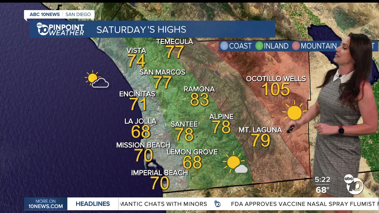
Saturday will be just about as cool as Friday with 70s for most of the county! Some 60s for the coolest coastal spots and a few 80s for the warmer inland and mountain neighborhoods, and around 105 in the deserts. These temperatures are anywhere from 3 to 13 degrees below average!
Gradual warming next week with highs closer to average by midweek, with continued warming at week's end as high pressure expands west. By Thursday, we'll see highs near 80 at the coast, 90s inland to the mountains, and near 115 in the deserts.
Monsoon moisture may return for the second half of next week, making things more humid and possible showers and thunderstorms over the mountains and deserts.
Saturday's Highs:
Coast: 67-74°
Inland: 73-83°
Mountains: 77-87°
Deserts: 103-106°
Follow ABC 10News Meteorologist Megan Parry on Facebook at Megan Parry 10News, Instagram @mis_meg_wx and Twitter @10NewsParry.
