

The marine layer was slower to clear today with little to no clearing at some beach communities. This pattern will continue through at least Saturday with slow clearing inland and limited to no clearing from the beaches to a mile or two inland.
Patchy drizzle or misty conditions will be possible overnight and in the morning hours, as well as pockets of dense fog in the foothills, like in Ramona.
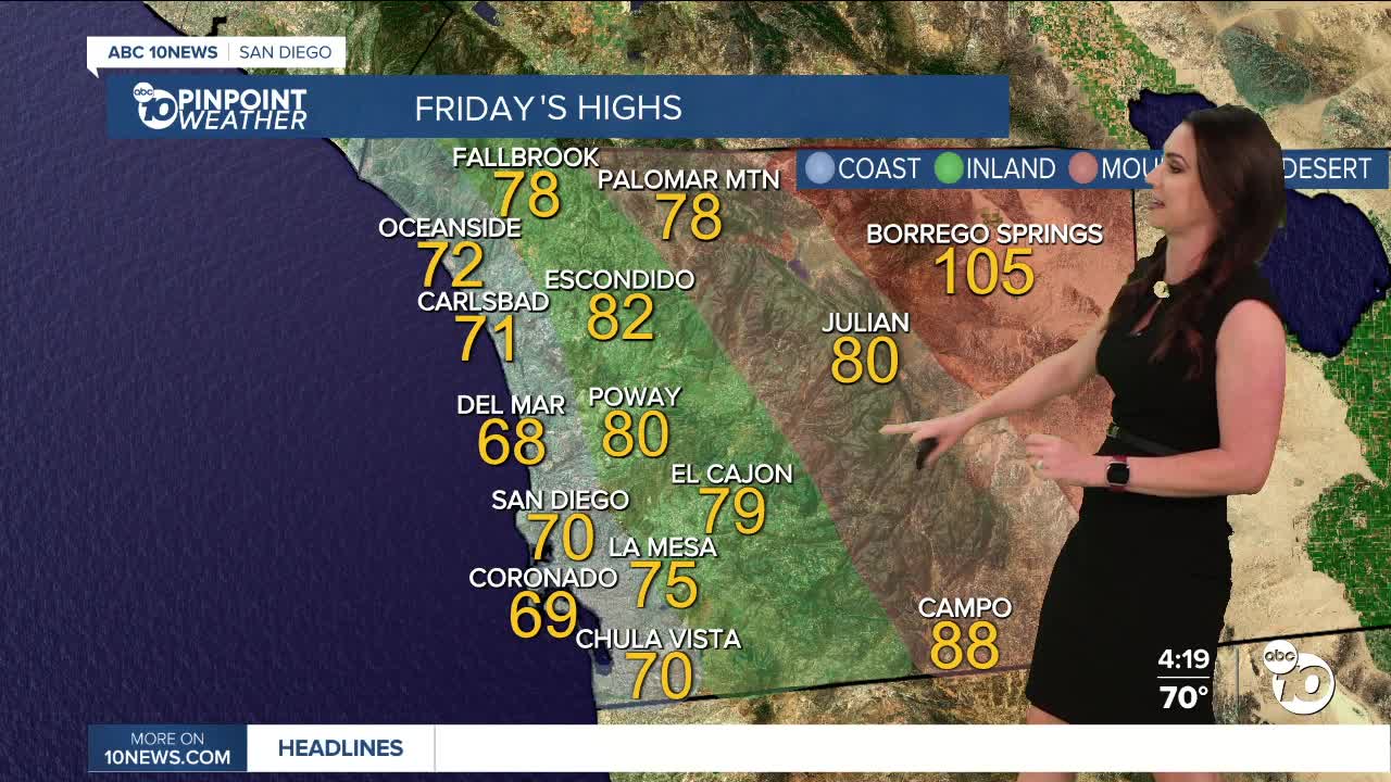
The coolest days will be Friday through Sunday with upper-60s to low-70s at the coast, mostly mid-70s to low-80s inland, mid to upper-70s in the mountains, and low-100s in the deserts. These temperatures are anywhere from 2 to 10 degrees below average!
Gradual warming next week with highs closer to average by midweek as high pressure expands west. Expect highs near 80 at the coast, back in the 90s inland, near-90 in the mountains and around 110 degrees in the deserts.
Monsoon moisture may return for the second half of next week, making things more humid.
Friday's Highs:
Coast: 67-75°
Inland: 74-84°
Mountains: 78-88°
Deserts: 104-108°
Follow ABC 10News Meteorologist Megan Parry on Facebook at Megan Parry 10News, Instagram @mis_meg_wx and Twitter @10NewsParry.
