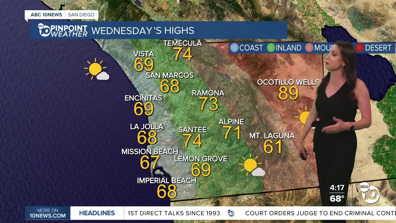


Temperatures will trend near average on Wednesday under mostly sunny skies.
A storm passing to the north will bring more clouds on Thursday, a minor dip in temperatures and gusty winds. Strongest winds will target the mountains and deserts with westerly gusts of 25 to 45mph and isolated gusts over 50mph.
The wind turns offshore Friday and Saturday, helping warmer temperatures back up. East and northeasterly winds of 25 to 45mph will target the inland valleys and mountains with stronger peak gusts in the wind-prone areas.
Saturday will be the warmest day for the coast and valleys, in the 70s at the coast and near 80 inland. While the mountains and deserts will be warmer on Sunday, with 60s in the mountains and 90s in the deserts.
Another storm is expected to stall over the Pacific this weekend and as it pushes onshore, potentially bring a chance of showers early next week. There remains uncertainty on track timing so stay with the Pinpoint Weather Team for updates, San Diego's Most Accurate Forecast.
Wednesday's Highs:
Coast: 67-71°
Inland: 69-75°
Mountains: 60-73°
Deserts: 86-89°
Follow ABC 10News Meteorologist Megan Parry on Facebook at Megan Parry 10News, Instagram @mis_meg_wx and Twitter @10NewsParry.
