

The rest of the weekend will stay warm and fairly clear. While that sun isn't going anywhere, the heat sure is!
Saturday brought minimal showers to a portion of the San Diego County mountains, with Mt. Laguna receiving 0.01" and Campo receiving 0.02" of rainfall.
Sunday will come with more chances for showers and thunderstorms in the mountains, although those chances are very slight. Any rainfall would come in the late afternoon to early evening.
As for the coast, Sunday will start with patchy fog in some areas. However, it won't be very dense, so visibility won't be reduced to levels that will truly impact any morning commute.
Other than that, you can get excited about sunny skies once again and temperatures right around or slightly above average. That puts the coast in the mid-70s to mid-80s and the valleys in the mid-80s to low-90s.
Moving forward, everyone will enjoy a major drop on the temperature roller coaster. Daytime highs will decrease by about 10-15 degrees from Sunday to Wednesday.
That means much of the the coast will be in the low 70s to upper 60s, the valleys in the mid-70s, the mountains in the upper 60s and deserts in the low 90s.
Temperatures will then rebound fairly quickly by the weekend, but will remain below average.
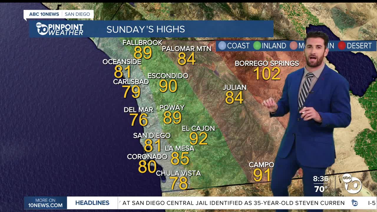
Sunday's Highs:
Coast: 76-86°
Inland: 86-93°
Mountains: 77-91°
Deserts: 96-102°
Follow ABC 10News Weather Anchor Max Goldwasser on Instagram, Facebook and Twitter.
