

The rest of the holiday weekend in San Diego will stay warm and sunny, and while a cool down is set to follow, so will more chances for showers and thunderstorms.
The entire county will feel the heat once again on Labor Day, with the coast climbing into the mid-70s to low 90s and the valleys in the low-to-upper 90s.
In fact, the valleys will enter a Heat Advisory starting 10 a.m. Monday and lasting through 6 p.m. Tuesday. Temperatures will top out around 5-10 degrees above normal in that window.
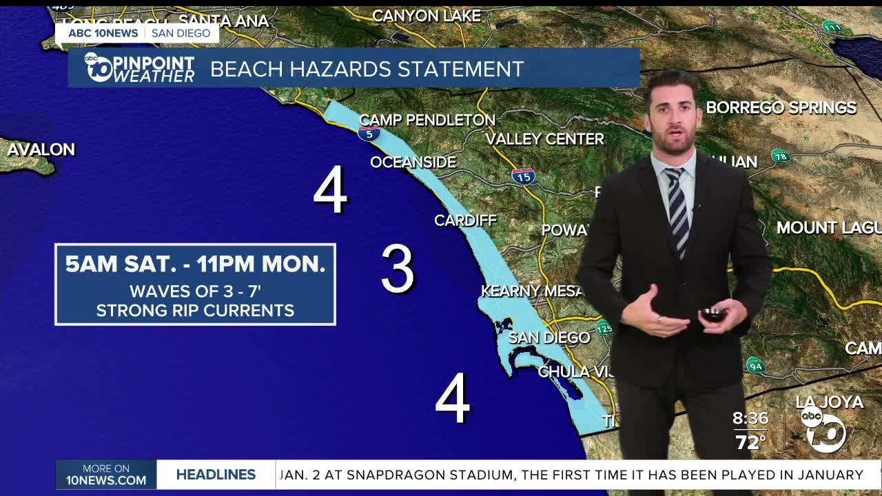
Meantime, the coast is still under a Beach Hazards Statement through Monday evening, during which there will be an elevated surf of 3-6 feet with sets up to 7 feet combined with strong rip currents. We know many of you want to hit the beach to celebrate the day off (as you should), just please do so with caution!
Overnight Monday into Tuesday is when the dry air escapes the county and monsoon moisture returns. That's when the mountains and deserts could see chances for thunderstorms return.
All four regions (coast, inland, mountains and deserts) have a chance at seeing that activity on Tuesday, with the greatest chances coming in the afternoon for east county communities.
That's the only day the coast could see showers and thunderstorms. Inland areas will see chances stick around on Wednesday as well.
The mountains and deserts have chances for showers and thunderstorms in the forecast every day from Tuesday through Saturday, before mostly sunny skies return on Sunday.
During that span, temperatures will cool down across the board.
Everyone will see daytime highs fall back to at-or-below normal by Thursday and will continue to keep dipping by a few degrees after that through Saturday.
Monday's Highs:
Coast: 76-90°
Inland: 90-98°
Mountains: 85-99°
Deserts: 103-109°
Follow ABC 10News Weather Anchor Max Goldwasser on Instagram, Facebook and Twitter.
