

There's a lot to like about the forecast for the rest of the holiday weekend! It'll stay warm and sunny through Labor Day, but then chances for showers and thunderstorms return.
As for Sunday, temperatures will be up to 6 degrees above average across the board, putting the coast in the mid-70s to low 90s, with most inland communities in the 90s as well, including Ramona which will top out close to 100 degrees!
The coast is under a Beach Hazards Statement through Monday evening, with an elevated surf of 3-6 feet and dangerous rip currents expected. We know many of you will want to spend the holiday weekend on the coast (as you should!), but please keep this in mind if you plan on being in and around the water.
Monday is also when a Heat Advisory takes effect for inland neighborhoods, starting at 10 a.m. and lasting through 6 p.m. Tuesday.
Temperatures inland will climb 5-10 degrees above normal, putting most locations well into the 90s and some, like Ramona, potentially hitting triple digits.
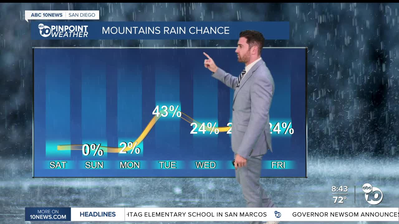
Tuesday is when monsoon moisture works its way back into the region bringing chances for showers and thunderstorms once again. Those chances start in the morning in the mountains and deserts, before potentially reaching the valleys by the afternoon.
The valleys might see showers and thunderstorms Tuesday and Wednesday, which the mountains and deserts could see that activity all the way through next Saturday.
The coast is not expecting to receive any precipitation in the extended forecast.
Sunday's Highs:
Coast: 76-90°
Inland: 89-98°
Mountains: 84-97°
Deserts: 104-110°
Follow ABC 10News Weather Anchor Max Goldwasser on Instagram, Facebook and Twitter.
