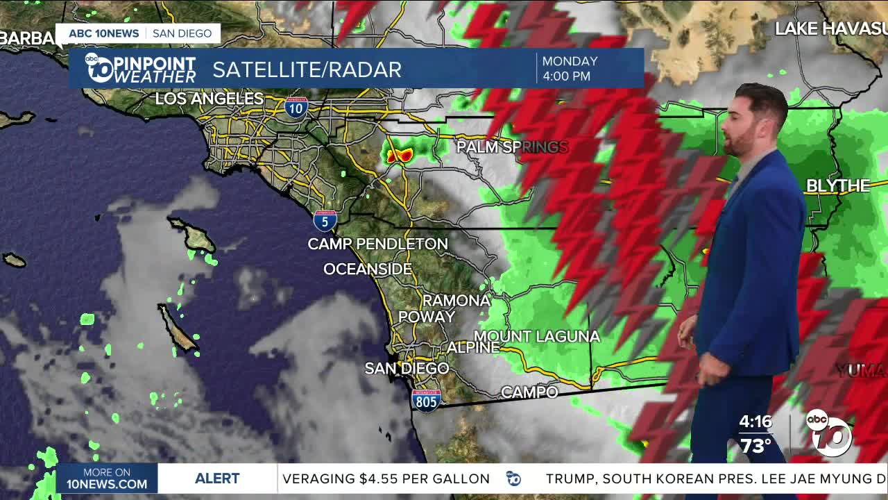


We've seen thunderstorm activity all across eastern San Diego County, and while that activity could bleed into Tuesday, the chances get weaker the deeper we move through the week.
As far as rain totals for Monday through 5 p.m., Historical County Road S2 near Carrizo Valley received the most at 1.17", Ocotillo wasn't too far behind at 1.03" and Mt. Laguna hit 0.37".
Monday also saw a few weather alerts in that region, like several Flash Flood Warnings, a Flood Advisory and a Severe Thunderstorm Warning, all of which were initiated after 2 p.m. and expired between 4-5 p.m.
It's not just happening in San Diego County — we've seen it all throughout Southern California. In fact, a partial ground stop was ordered for some flights at LAX.
From 5 p.m. on, the rest of Monday will be dry locally.
Most areas outside the coast could see showers Tuesday afternoon. The greatest chances once again come in the mountains and deserts, where some of that storm activity could even hit in the morning, although it's not likely.
Chances for showers and thunderstorms now stretch all the way into Friday, with the coast potentially receiving some rain during that span on Thursday.
However, we will be rewarded on the backend.
A sunny, dry and warm Labor Day Weekend is in store!
Tuesday's Highs:
Coast: 72-81°
Inland: 83-91°
Mountains: 77-90°
Deserts: 96-101°
Follow ABC 10News Weather Anchor Max Goldwasser on Instagram, Facebook and Twitter.
