

Get ready for a nice weekend in San Diego! We’re staying cool and calm, with some clouds sticking around at the beaches through at least Saturday. We heat up mid next week.
This morning the marine layer is a bit deeper, meaning it’s sitting a bit higher in the sky, with the cloud layer at about 2500 feet.
It will be a cloudy morning along the coast and inland, with slow clearing. Within a mile or two of the water, expect clouds to stick around throughout the day.
This pattern will hold through at least Saturday, when the marine layer gets a bit shallower.
Our daily highs will also be cooler than normal for the middle of August.
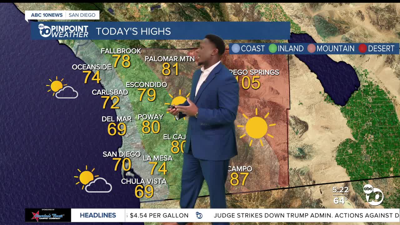
The coast will reach around 70, with a mix of sun and clouds once you get a mile or two away from the water. Inland highs will be around 80°, with is about 10° below normal!
The mountains will mostly see low 80s, with the potential for haze from wildfire smoke. Meantime the deserts will reach low triple-digits.
By Monday, we slowly begin to warm up. By Thursday the coast will see upper 70s while inland communities will hit low 90s.
A surge of monsoon moisture is anticipated for the end of next week, so things could be hot and humid by Thursday!
Friday’s Highs:
Coast: 68-74°
Inland: 77-85°
Mountains: 81-87°
Deserts: 100-105°
Follow ABC 10News Weather Anchor Moses Small on Instagram, Facebook and Twitter.
