

After forecasting chances for thunderstorms and lightning over the last few days, we finally saw that activity in San Diego County on Wednesday.
A Special Weather Statement went into effect as a result for an area near Julian. It lasted less than an hour, from 2:55 p.m. through 3:45 p.m.
The afternoon monsoonal storm was mainly isolated to the mountains, where Warner Springs received 0.35" total on Wednesday with Julian receiving 0.17" of rain.
It briefly triggered a Flood Advisory around 3:30 p.m. and was originally supposed to go until 6:30 p.m., but the National Weather Service canceled it about two hours early, indicated this system was not as impactful as initially expected.
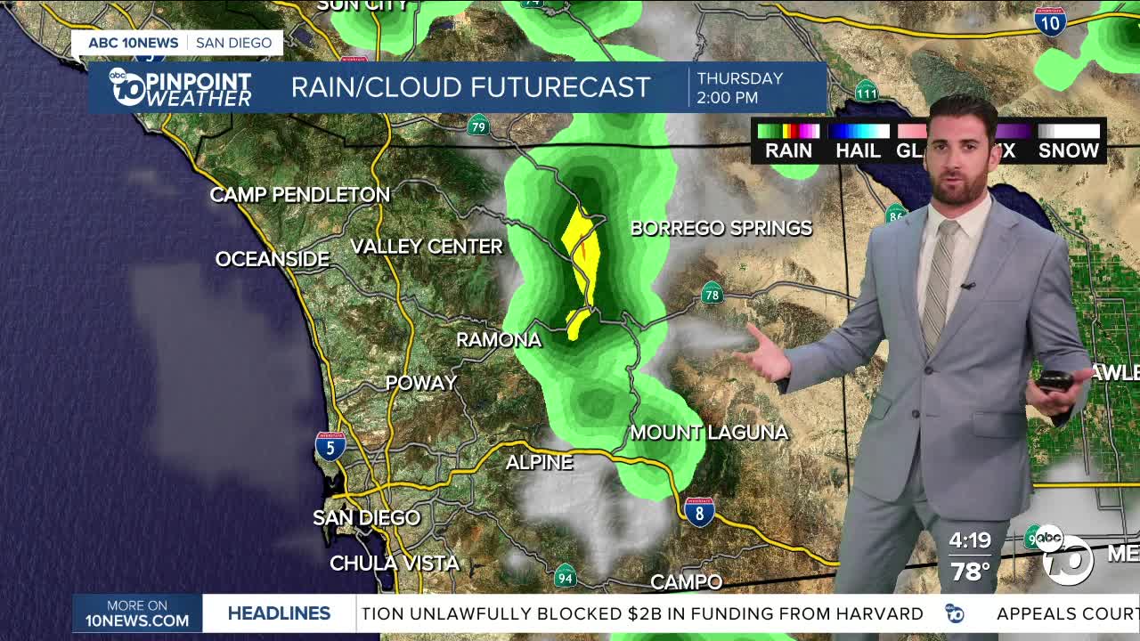
Thunderstorm chances continue to hit mainly the mountains and deserts through Thursday, with those chances decreasing Friday onward.
Any activity will start in the early afternoon and last into the early evening. Other than that, expect fairly clear conditions.
A minor to moderate heat risk is still affecting the entire county through Thursday as well, including the coast which will top out in the mid-70s to mid-80s, and much the valleys which will climb into the 90s again.
A gradual cool down will follow through next week, during which daytime highs will dip by about 5 degrees on the coast and in the deserts, and 10 degrees in the valleys and mountains.
Thursday's Highs:
Coast: 75-85°
Inland: 87-94°
Mountains: 77-91°
Deserts: 96-101°
Follow ABC 10News Weather Anchor Max Goldwasser on Instagram, Facebook and Twitter.
