

After another warm, sunny and dry day to wrap up Labor Day Weekend, more chances for showers and thunderstorms return to the forecast.
The Beach Hazards Statement on the coast expires Monday evening, but an elevated surf and strong rip currents are still expected Tuesday, although not as extreme.
The valleys will still be under a Heat Advisory Tuesday as well until 6 p.m., during which temperatures will top out in the upper 80s to mid-90s. That's up to five degrees above normal, but a few degrees cooler than Monday's daytime highs.
Temperatures will gradually cool down throughout the week across the county, by about 5-10 degrees from start to finish.
However, that cooler weather also comes with an increase in humidity thanks to a return of monsoon moisture, and in turn, an increase in chances for showers and thunderstorms.
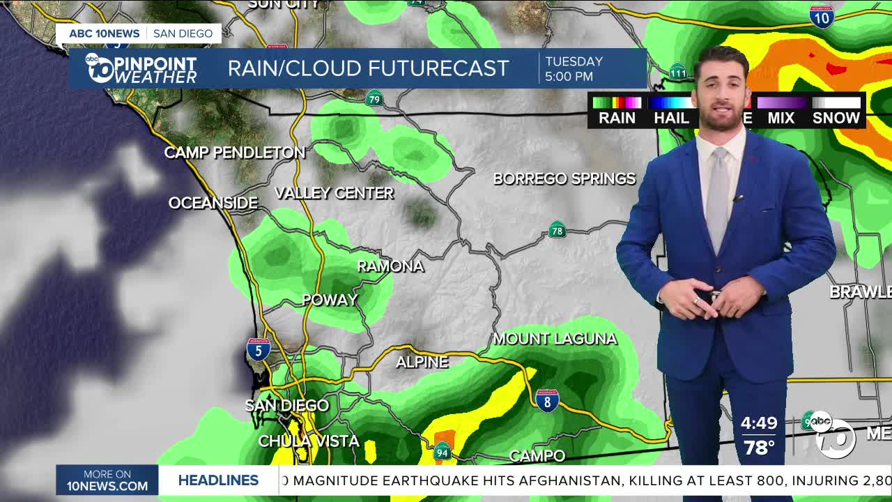
Everyone has a chance at seeing that activity overnight Monday into Tuesday, although it's a slight chance at that.
Those chances pick back up in the afternoon, especially in the mountains and deserts where showers are likely and thunderstorms are possible.
Some inland areas have a good chance at seeing some as well, including Ramona, Valley Center and Alpine.
After Tuesday, the coast is expecting nothing but mostly sunny skies the rest of the way. The same cannot be said for the rest of the region.
Inland neighborhoods have a chance at seeing storms through Friday. The mountains and deserts could see them through Saturday, although the highest chances come Tuesday and Wednesday.
Once we get through this next round of monsoon moisture, we will be dry and sunny once again Sunday and Monday.
Tuesday's Highs:
Coast: 77-90°
Inland: 88-95°
Mountains: 77-91°
Deserts: 95-102°
Follow ABC 10News Weather Anchor Max Goldwasser on Instagram, Facebook and Twitter.
