

Santa Ana winds are still giving us gusty conditions across much of the county, with a High Wind Warning in effect for the mountains and a Wind Advisory in the valleys.
Both of those alerts expire Sunday at 1 p.m.
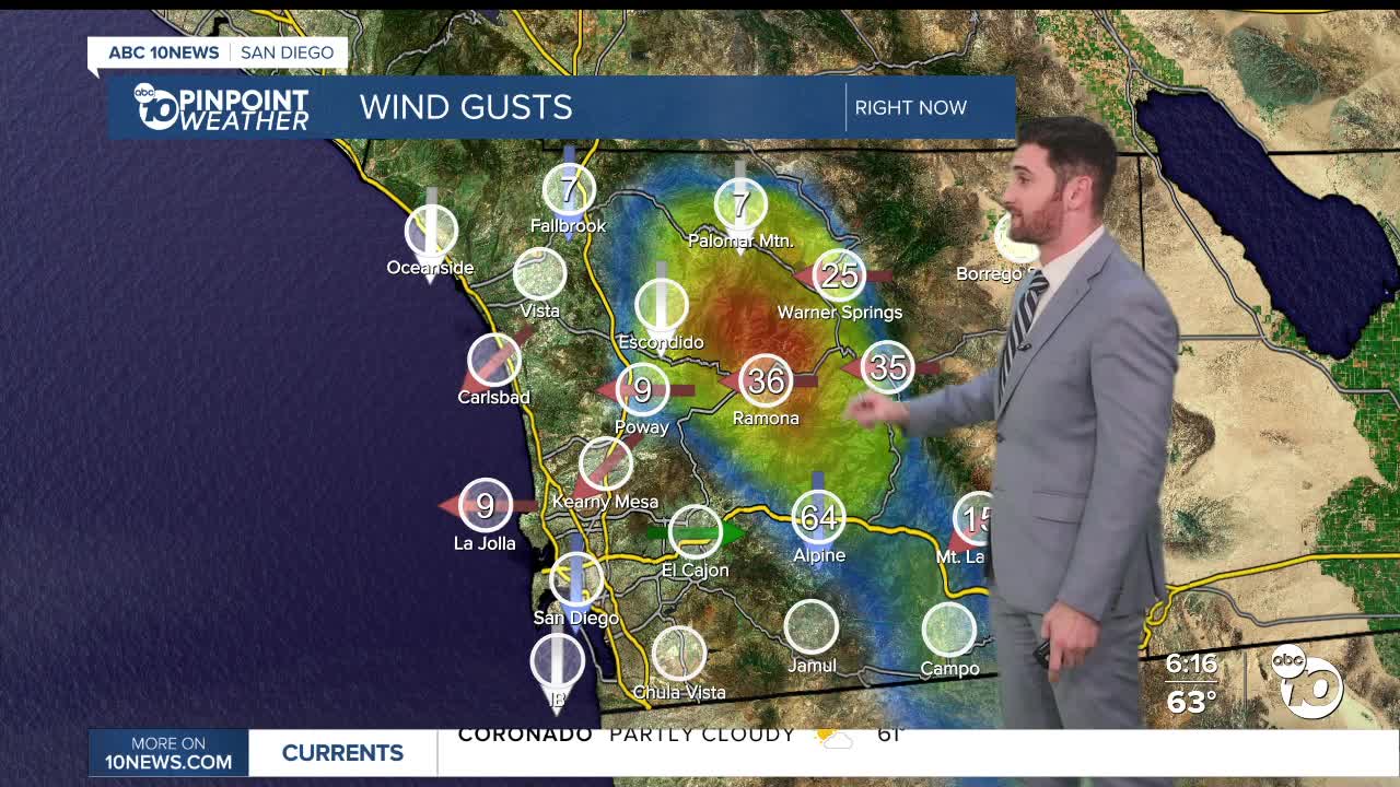
In the meantime, those areas have seen some incredibly strong wind peaks over the last 24 hours. Here are some of the more notable numbers:
Sill Hill (SW of Julian): 88 mph
Big Black Mountain: 82 mph
Cuyamaca Peak: 76 mph
Hauser Mountain (near Campo): 75 mph
Alpine: 63 mph
Ramona: 47 mph
Sunday you can expect much of the same, with most easterly breezes sustained between 35-45 mph and some isolated gusts clocking in around 65+ mph.
Even after the High Wind Warning and Wind Advisory both come to their scheduled end, the wind speeds will remain strong all next week.
The deserts will be cold Saturday into Sunday, falling into the mid-30s, which could bring some patchy frost.
Temperatures on Sunday will continue our warming trend, with everyone climbing back to at-or-above average conditions.
We only get warmer after that. Our daytime highs on Wednesday will be 10-15 degrees above normal. That means the coast will be back in the low-to-upper 70s and the valleys in the upper 70s to low 80s.
Do I dare say beach day??
Keep in mind, as we warm up and our winds remain strong, our relative humidity will decrease, meaning we will get even drier. As we know here in Southern California, those are the ingredients for an elevated fire risk.
Sunday's Highs:
Coast: 69-73°
Inland: 66-76°
Mountains: 45-61°
Deserts: 63-69°
Follow ABC 10News Weather Anchor Max Goldwasser on Instagram, Facebook and Twitter.
