

Happy Monday & Happy Groundhog Day!
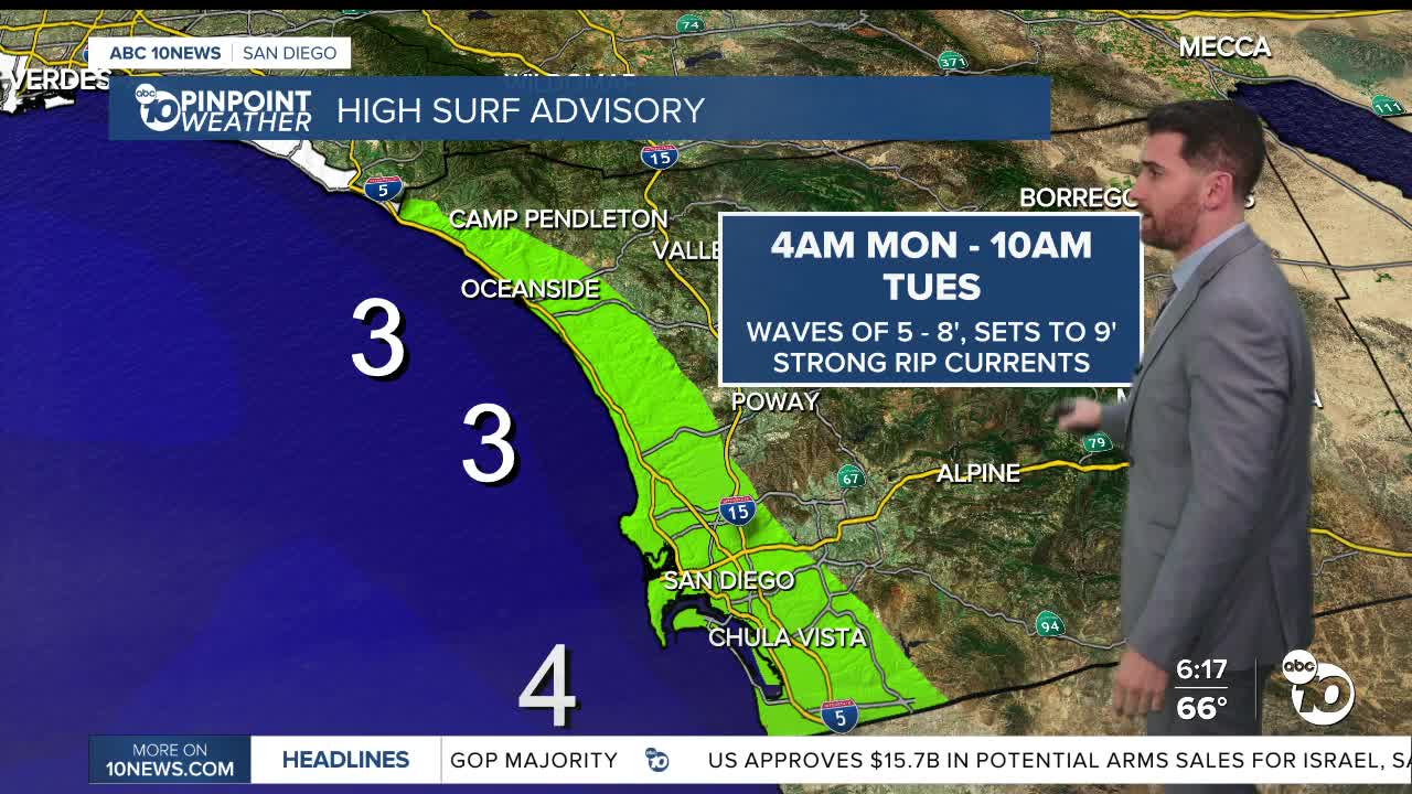
We start things off this week with two advisories on the coast — a High Surf Advisory and a Coastal Flooding Advisory. Both take effect 4 a.m. Monday and last through 10 a.m. Tuesday.
Waves in this window will range between 5'-8' with sets around 9' paired with strong rip currents. That can sometimes lead to flooding in low-lying areas near the beach, including parking lots.
High tide is around 8:50 a.m. Monday and low tide is around 3:45 p.m.
The coast could see patchy fog in the morning, but is more likely to appear late Monday into early Tuesday, stretching inland as well.
Monday will be partly cloudy. Temperatures will be cooler than this weekend — in fact, they are around the coolest point of the week for the coast and inland valleys — but still remain warmer than normal.
Temperatures in those areas climb by 10+ degrees by Wednesday before cooling off again into the weekend.
The mountains and deserts see a minimal increase in temperatures through Wednesday before dropping off about 5 degrees into Thursday.
The mountains and valleys will also see the return of Santa Ana winds Wednesday and Thursday.
Monday's Highs:
Coast: 66-74°
Inland: 73-79°
Mountains: 61-74°
Deserts: 75-80°
Follow ABC 10News Weather Anchor Max Goldwasser on Instagram, Facebook and Twitter.
