

Santa Ana winds will be whipping to end the year, all before more rain moves into the region the kick off 2026.
A High Wind Watch, which was set to start for the mountains and deserts at 4 p.m. Monday, was upgraded to a Wind Advisory and took effect 24 hours earlier.
Here's a look at some notable wind gust peaks in San Diego County on Sunday:
Otay Mountain: 44 mph
Boulder Creek: 37 mph
Pine Valley: 35 mph
Julian: 34 mph
Palomar Mountain: 34 mph
Ramona: 29 mph
Gusts will get even stronger on Monday and Tuesday, peaking closer to 50-70 mph, especially in the more wind prone passes.
As far as temperatures go, everyone will be right at or slightly above average Monday and Tuesday.
Those temps will start to fall a bit by midweek, around the same time chances for showers are back in the forecast.
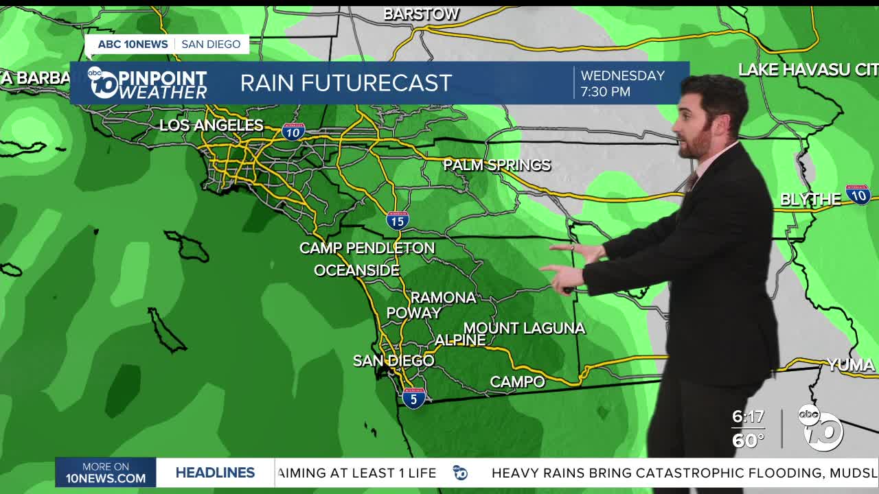
San Diego County could receive rain New Year's Eve, beginning with the coast in the morning.
Everyone should see rain New Year's Day, with heavy rainfall possible in the morning.
Then chances for showers stretch all the way into next Sunday.
It's likely the rainfall totals will be at least 0.5"-1.0" in that span.
Monday's Highs:
Coast: 67-74°
Inland: 67-75°
Mountains: 46-61°
Deserts: 64-71°
Follow ABC 10News Weather Anchor Max Goldwasser on Instagram, Facebook and Twitter.
