

A break from the active weather this weekend, with sunny skies and cooler temperatures, all before strong winds and rain return to the forecast.
To appreciate where we are at, let's first look back at where we've been. Here are some notable 4-day rain totals for San Diego County:
Palomar Mountain: 2.92"
Fallbrook: 1.32"
Chula Vista: 1.02"
Alpine: 0.99"
National City: 0.88"
San Diego: 0.80"
We cleared up and dried up on Saturday, although daytime highs fell several degrees across the board.
Temperatures on Sunday will get a bump, putting us right back to or slightly above average.
Winds will be breezy as well, signaling the start of our next Santa Ana wind event.
Winds peak to start the week, putting the mountains and valleys under a High Wind Watch from 4 a.m. Monday through 1 p.m. Tuesday.
There is high confidence those easterly winds will sustain between 15-30 mph, with some stronger gusts clocking in around 45-60 mph.
Chances for showers are back on New Year's Eve, with rain likely New Year's Day, January 2nd and possibly stretching into the 3rd.
Fun start to 2026 indeed!
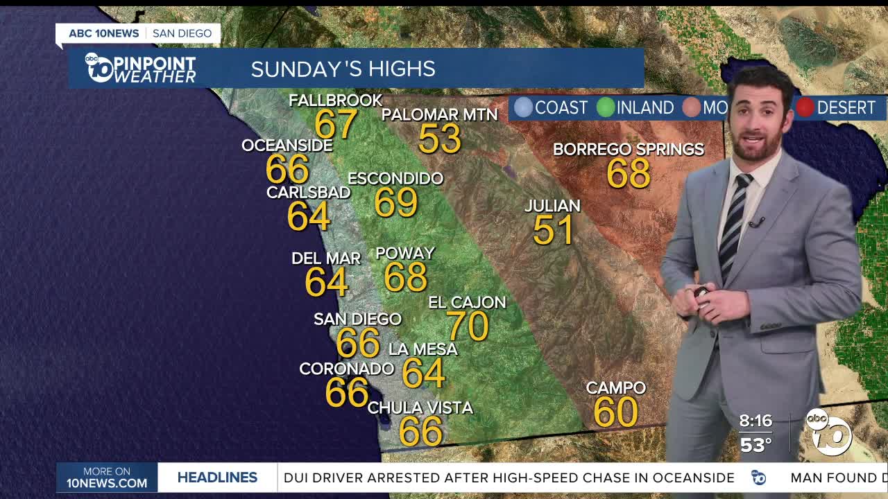
Sunday's Highs:
Coast: 63-68°
Inland: 64-72°
Mountains: 45-60°
Deserts: 63-69°
Follow ABC 10News Weather Anchor Max Goldwasser on Instagram, Facebook and Twitter.
