

SAN DIEGO (KGTV) — San Diego County is bracing for another round of unseasonably hot weather this weekend, with several communities on track to challenge or break daily temperature records.
Forecasters are calling for record highs on Saturday in areas including Ramona, Alpine, Borrego Springs, Campo, Lake Cuyamaca, and Palomar Mountain. Other cities—like Escondido, Vista, and Chula Vista—are expected to come very close to record territory.
In fact, daily record highs are possible through the weekend, especially across the mountains and deserts, with some inland areas also nearing historic levels.
Temperatures across most of the county will run 10 to nearly 25 degrees above average, making Friday and Saturday the warmest days of the week.
The heat is being driven by a ridge of high pressure building over the region—similar to last week’s setup, though not quite as intense as the system that produced all-time March records.
While inland areas heat up, coastal communities will start to see a familiar shift.
Low clouds and patchy fog are expected to return late Friday night into Saturday morning, bringing a mix of sun and clouds along the coast and into the valleys throughout the weekend.
Relief is on the way. A storm system passing north of the region will bring a significant cooling trend next week, with temperatures dropping 10 to 25 degrees from this weekend’s peak heat.
By Wednesday, temperatures will fall back to near or slightly below average, making it the coolest day of the upcoming week.
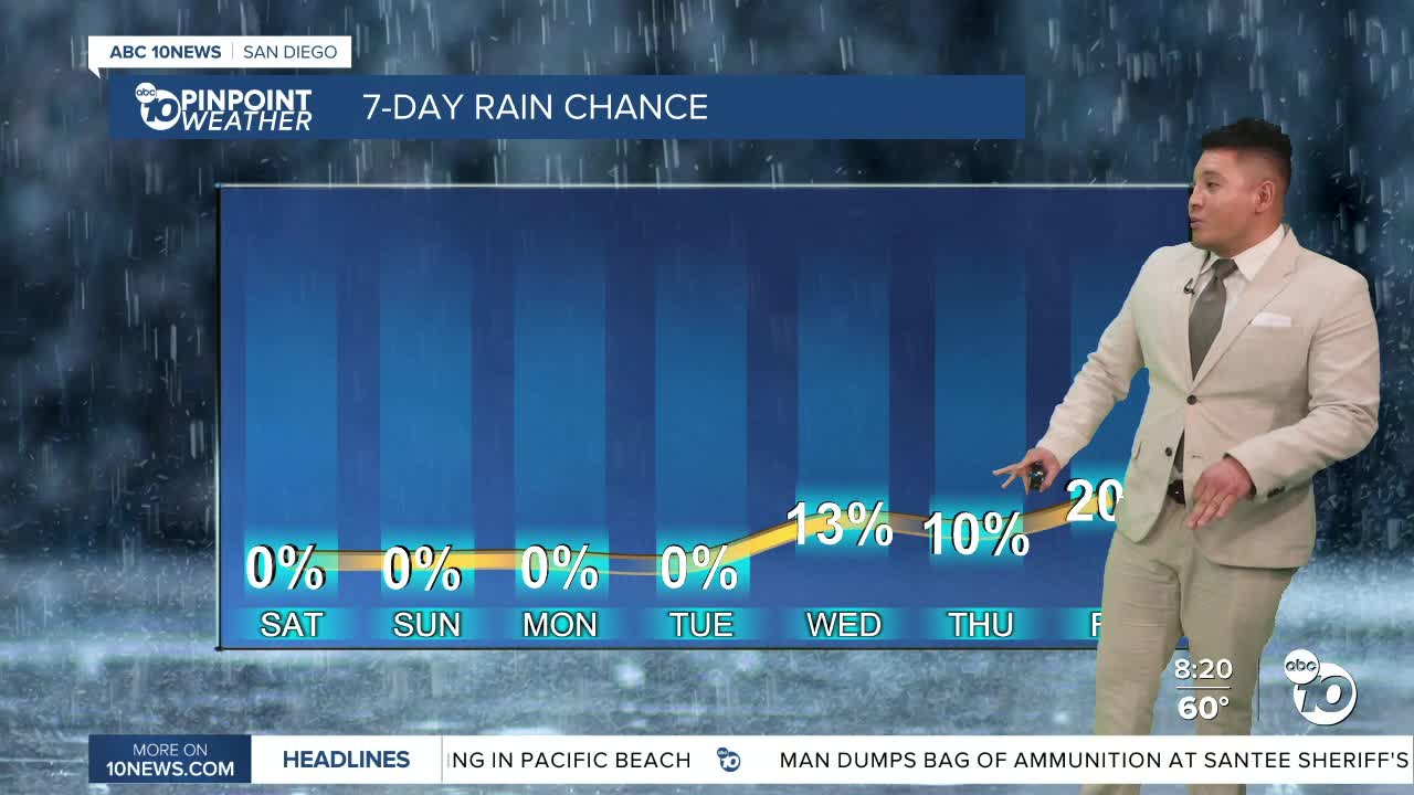
That same system could also bring a slight chance of light showers, beginning as early as Tuesday, with the best chances on Wednesday and possibly lingering into Thursday.
Rainfall totals are expected to remain light, with early estimates showing less than a tenth of an inch from the coast to the mountains.
SATURDAY’S FORECAST HIGHS
- Coast: 67–71°
- Inland: 68–72°
- Mountains: 50–62°
- Deserts: 75–78°
