

SAN DIEGO (KGTV) — It's shaping up to be a lovely Valentine's Day weekend, but the biggest storm of the season is on the horizon.
This weekend will stay quiet and clear across the board. No rain showing up, and that's really going to set the tone for the rest of the day and through the weekend. Smooth sailing weather-wise for now.
For Valentine's Day itself, it doesn't get any better than this — so definitely take advantage of it. Temperatures in the 60s and 70s no matter where you are — coast, inland, mountains, or deserts. Plenty of sunshine, light winds — a perfect day for a dinner cruise, a rooftop restaurant, or just a walk along the beach as the sun goes down.
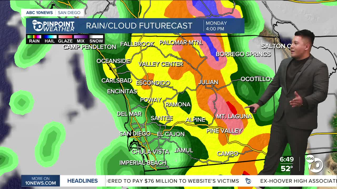
But enjoy it — because changes are on the way. As we head into next week, rain chances really ramp up. In fact, it's not often you see a 100% chance of rain — and that's exactly what we're looking at. Expect periods of heavy rainfall and even the possibility of thunderstorms.
When it comes to rainfall totals, flooding is very likely — especially early next week. We're talking about around 1 to 2 inches of rain, with locally higher amounts possible.
Mild and dry this weekend with breezy south winds developing over the mountains and deserts Sunday afternoon. A winter storm will bring moderate to heavy rain, mountain snow, and gusty winds Monday and Tuesday along with a slight chance of thunderstorms Monday evening. Snow levels fall through Wednesday, with elevations above 5,000 to 6,000 feet likely to see heavy snow and significant impacts. Additional chances of showers on Thursday, lowering to around 10% Friday.
Saturday's Highs:
- Coast: 63-69°
- Inland: 66-73°
- Mountains: 56-69°
- Deserts: 76-79°
