

They say don't judge a book by its cover. Well, you shouldn't judge a weather week based on how it starts.
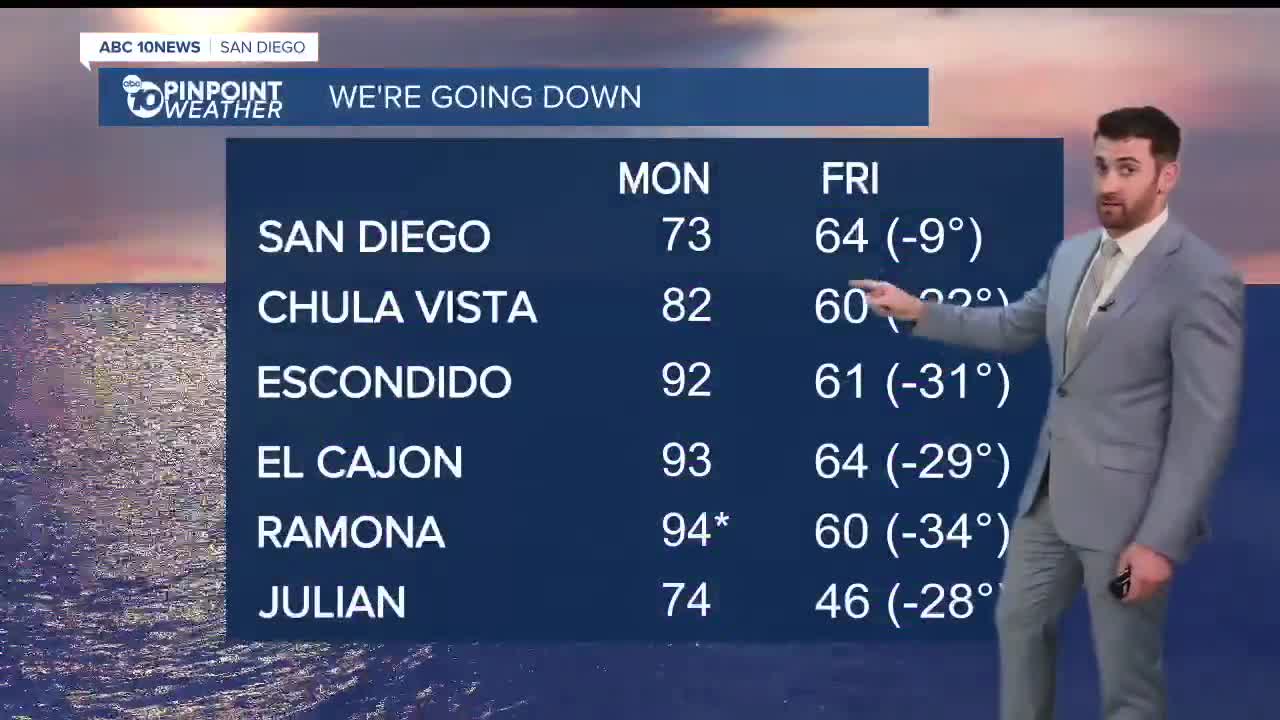
On Monday, Ramona (94) and Borrego (91) set heat records. Those who didn't were still well above average, paired with mostly sunny skies.
Patchy fog will hit the coast once again and stay overnight into Tuesday morning, reducing visibility to less than a mile in some areas before clearing out by 7:30/8:00 a.m.
Tuesday is Veterans Day! We want to thank our active-service and retired military members across the county and the country.
Temperatures will top out around 5 degrees above normal on the coast, ranging from the low 70s to low 80s. Inland neighborhoods will be closer to 10 degrees above normal, in the low-to-upper 80s.
We cool down even more by Wednesday, by about 5-10 degrees across the county, to go along with mostly cloudy skies.
Just one day later is when the changes will truly begin.
Rain chances enter the forecast on Thursday, as do breezier conditions for the mountains and deserts.
That rain should hit the coast, valleys and mountains Thursday through Saturday, with the deserts potentially seeing some precipitation on Friday. Rain totals will range between 1-1.5" in the coast and valleys with 1.5-2.25" on the way in the mountains and deserts.
Temperatures will hit their low point on Friday, and in some cases, will be more than 30 degrees cooler than where we topped out on Monday, with the biggest decreases coming in the valleys and mountains.
Sunday will dry up but remain cool, before more rain chances are back early next week.
Tuesday's Highs:
Coast: 72-81°
Inland: 82-89°
Mountains: 73-87°
Deserts: 86-92°
Follow ABC 10News Weather Anchor Max Goldwasser on Instagram, Facebook and Twitter.
