

SAN DIEGO (KGTV) — We're getting one last squeeze out of this system before the rain gives way to mostly cloudy skies, and eventually clear skies. This will allow flood-prone and low lying areas a chance to recover from all the recent flooding.
As you wake up this morning you're gonna see some slick roads and some stray showers here and there.
Right now, depending on where you are you'll see lower clouds and some stray showers the more inland you are.
All that rain put a huge dent in our rain bucket so far — most of that rain came in the New Year, and in just a single day on January 1st we had more rain than we typically do on average in the entire month of January.
Look at these totals so far — since October we've had just under 7 inches of rain when we normally get about 3 inches of rain. So hopefully we continue to head in the opposite direction of a drought.
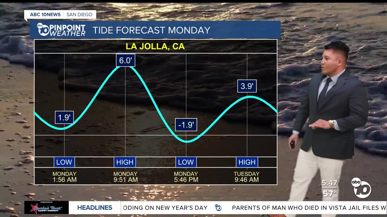
This morning you'll want to avoid the shore just after 9 a.m. — those swells are going to reach about 6 feet. And if you want to go tide pooling, best time to do that will be around closer to 4 this afternoon. Keep in mind though that we have a few marine protected areas — including South La Jolla Shores and Swamis — so don't take the marine critters out of the tide pools.
Because of the king tides and because of a higher swell from the incoming weather system, that's prompting a Beach Hazard Statement that's expected to last later this morning.
Finally moving on to the forecast — we're expecting fluctuating weather conditions this week. This weather system will bring periods of rain with chances for showers across the region through midweek. Chances of rain will last into tomorrow, and from there it becomes mostly cloudy. A high pressure ridge will bring Santa Ana winds and warm the region up again by next weekend.
Bottom line — keep the umbrella and the jacket handy, use extra caution on the roads and at the beach, and stay weather-aware as we work through this active stretch before drier weather returns late next week.
