

San Diego County is dealing with impact weather today, with gusty winds, cooler temperatures and scattered showers all in play.
The winds have been the biggest issue, especially through the mountains and East County, where strong gusts could make driving tricky at times. Drivers should use extra caution in wind-prone areas and along mountain roads.
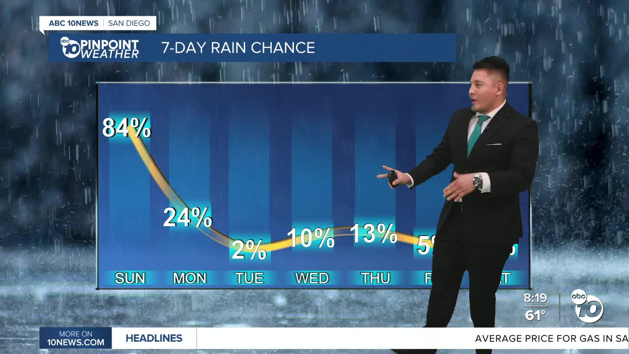
At the same time, scattered showers are moving across the county and will continue on and off through the day. The best chance for measurable rain will be along and west of the mountains, including parts of North County and areas near Palomar Mountain. Some spots could pick up close to a quarter of an inch.
Temperatures will stay well below normal, making for a noticeably cooler day across San Diego County. Showers may become a little more widespread this evening before tapering off overnight into early Monday.
By Monday, conditions begin to dry out and clear out, with slightly warmer temperatures returning as high pressure builds back in.
By the middle of the week, another system could bring a slight chance of showers and possibly a stray thunderstorm, but that track remains uncertain. Warmer and drier weather is expected by the end of the week.
Sunday's Highs:
Coast: 60-65°
Inland: 61-68°
Mountains: 42-52°
Deserts: 68-76°
