

SAN DIEGO (KGTV) — Low clouds and fog are expected to return along the coast late tonight into early Monday, which could make for a hazy start to the day in some beach communities and nearby valleys.
The marine layer will be a little shallower than it has been in recent days, so those clouds are not expected to spread as far inland. Even so, some coastal and valley areas could see reduced visibility early Monday morning before skies gradually clear by late morning.
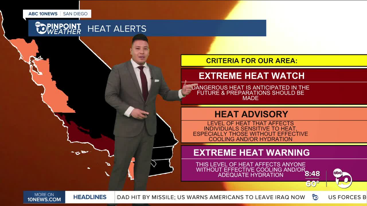
After that, the bigger story becomes the heat.
A strong ridge of high pressure is building over the West Coast and will bring a major warm-up to Southern California throughout the week. Coastal areas will warm into the upper 70s and low 80s, while inland valleys rise into the upper 80s and mid 90s.
Temperatures will continue climbing through the middle and end of the week, with the hottest days expected Thursday and Friday. Some areas could end up running as much as 30 degrees above average, and forecasters say both daily and monthly temperature records may be broken.
Because of that dangerous heat, an Excessive Heat Watch has been issued for the mountains below 5,500 feet and the deserts later this week.
The heat is expected to ease slightly next weekend, but until then, Southern California is heading into an unusually hot stretch with potentially significant heat impacts.
Sunday's Highs:
Coast: 78–82°
Inland: 88–95°
Mountains: 65–75°
Deserts: 96–100°
For the latest news, weather and traffic updates, follow Gabe Salazar on Facebook and Instagram.
