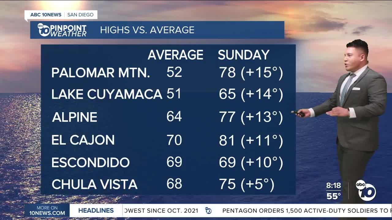


SAN DIEGO (KGTV) — Clear skies and sunny conditions will stick around as we wrap up the weekend and into early this week. Weak Santa Ana winds and high temperatures as much as 10 to 15 degrees above average for the valleys today and Monday.
A slow cooling trend is expected for Tuesday through the end of the week. The marine layer could return to the immediate coast for a few hours tonight into Monday morning but is not likely to stick around for Monday night into Tuesday morning as offshore flow makes a brief return.
A low pressure system will bring more noticeable cooling, increased clouds and small chances for precipitation as we approach next weekend.
At the surface, pressure gradients remain offshore and the windy areas have reported north to northeast winds gusting 30 to 40 mph. There remains no sign of marine layer low clouds or fog within 60 miles of the Southern California coast.
The trend through Monday morning is toward weaker offshore flow and this could allow low clouds and fog from a shallow marine layer to return to the immediate coast. The offshore flow strengthens again Monday night into Tuesday morning, pushing the dry air from inland toward the coast and most likely keeping the low clouds and fog offshore.
Meanwhile, the high pressure aloft will keep inland high temperatures 10 to 15 degrees above average through Monday. Temperatures across Southern California decline gradually from Tuesday through Thursday as the upper ridge weakens in response to a shortwave trough moving southeast from the Pacific Northwest and an upper low from the southwest being drawn northeast toward Southern California.
Sunday’s Highs:
Coast: 67-71°
Inland: 79-81°
Mountains: 50-62°
Deserts: 74-78°
Follow ABC 10News Weather Anchor Gabe Salazar on Instagram or Facebook.
