

A significant weather system is heading our way this week bringing all the elements with it — wind, rain and snow.
The system doesn't arrive until the start of the work week, though. That leaves partly cloudy skies for Sunday with temperatures right at or slightly below average for the coast and valleys, and slightly above average in the mountains and deserts.
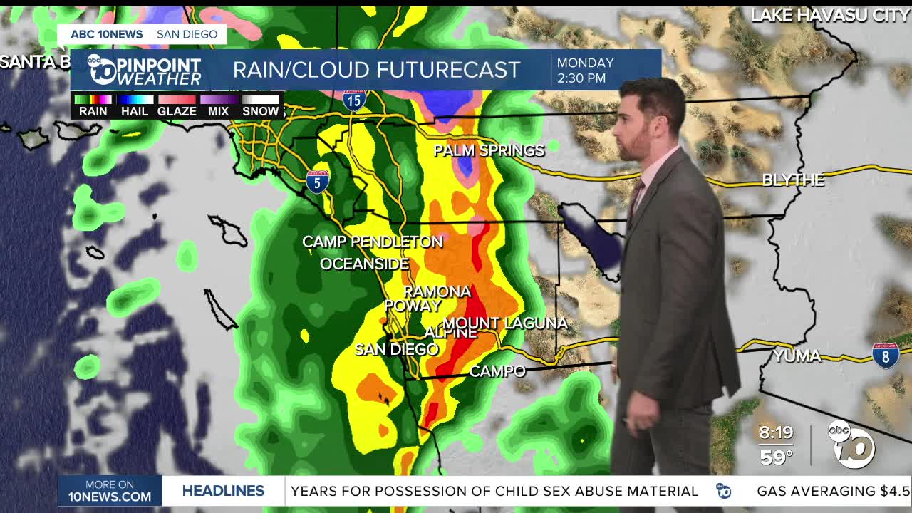
President's Day on Monday will see temperatures drop by up to 5-6 degrees. The first of two major rounds of rain is expected Monday, with the heaviest amounts falling Monday afternoon/evening and Tuesday night into early Wednesday.
Monday also marks the return of strong winds. The coast and valleys are under a Wind Advisory from 7 a.m. to 8 p.m. with the deserts under one from 10 a.m. to 1 a.m. Tuesday.
Meantime, the mountains will get hit with a High Wind Watch from early Monday into the night
Winds will range between 30-40 mph, with some stronger gusts clocking in at 50+ in the higher elevations.
One more thing to add to the mix Monday — a High Surf Advisory from 10 a.m. Monday through 4 a.m. Thursday. Wave heights could reach 8-12 feet. This will come with strong rip currents and potential minor coastal flooding.
The rain will continue Tuesday, Wednesday, with a chance on Thursday. The mountains should see some snow in this time frame with the snow level dropping as low as 4,000 ft.
It's unclear how much snow could arrive. As of now, estimates range from a dusting to several inches in the higher elevations.
As far as how much rain we could see Monday through Wednesday, early predictions put the coast and valleys at 1-2", the mountains at 2-5" and the deserts at 0.5-1.5".
Sunday's Highs:
Coast: 63-77°
Inland: 64-71°
Mountains: 53-63°
Deserts: 72-77°
Follow ABC 10News Weather Anchor Max Goldwasser on Instagram, Facebook and Twitter.
