

We are back to being pretty close to perfect in San Diego to wrap up the weekend and move through the work week!
The biggest headline is the Beach Hazards Statement that went into effect for the coast Sunday morning and will stick around through Tuesday, with an elevated surf of 4-7 ft. and sets to 8 ft., coming with the risk of strong rip currents as well.
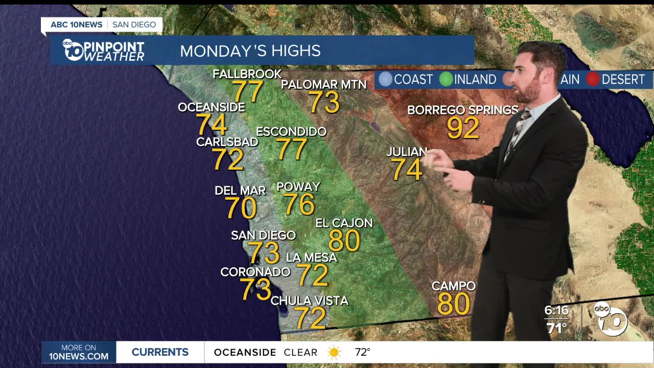
Temperatures will stay below average on Monday by up to 7 degrees, putting the coast in the low-to-mid-70s and the valleys in the mid-70s to low-80s.
Then we enter a slight and gradual warming trend through Friday, during which daytime highs will only increase by about 3-5 degrees. A minor cool down will follow through next weekend.
Monday will also start on a cloudy note for the coast before making way for partly cloudy skies, with mostly sunny conditions expected everywhere else.
Tuesday could see a bit of a breeze pick up as well, with gusts along the coast and in the valleys peaking around 25 mph, while the mountains and deserts might see gusts hit 30 mph.
Overall, this should shape up to be a nice, relatively cool and sunny week in San Diego County!
Monday's Highs:
Coast: 70-76°
Inland: 76-82°
Mountains: 71-80°
Deserts: 87-93°
Follow ABC 10News Weather Anchor Max Goldwasser on Instagram, Facebook and Twitter.
