



Good morning San Diego!
We're staying warm and windy this Saturday, with temperatures in the 80s and 90s across the coast and inland valleys, and fire danger remaining elevated as Santa Ana winds continue.
A Heat Advisory is in effect for the coast until 8 p.m. tonight, with highs ranging from the mid-80s to mid-90s. Temperatures will be running about 5 to 15 degrees above average, so even though Friday brought the peak of this heat and wind event, it’s still going to feel like summer across much of the county.
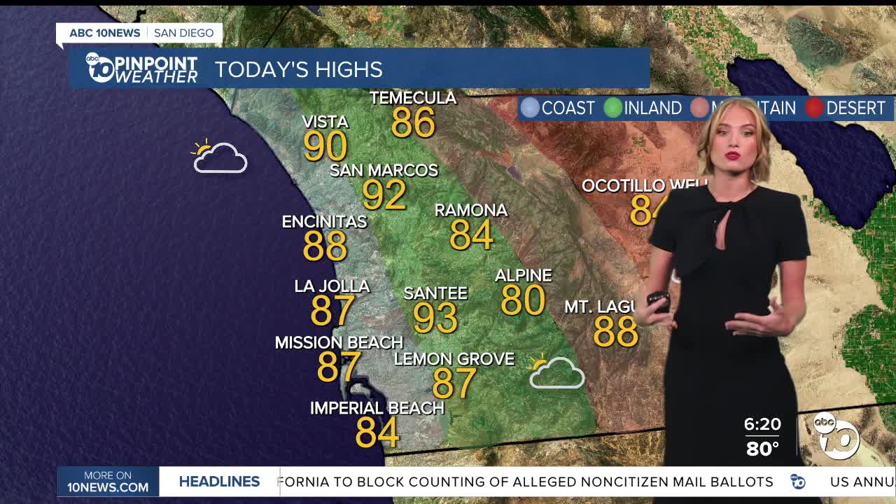
Highs today will reach 83 to 91 degrees along the coast, 81 to 92 inland, 57 to 74 in the mountains and 82 to 85 in the deserts.
We’re also still tracking strong Santa Ana winds. A High Wind Warning remains in effect for inland valleys until 8 p.m. tonight, with sustained winds of 15 to 30 miles per hour and gusts of 35 to 55 miles per hour, potentially higher in some locations.
In the mountains, winds will be even stronger, with sustained winds of 25 to 35 miles per hour and gusts reaching 50 to 65 miles per hour, with isolated higher gusts. That warning continues until midnight tonight.
We could also see more clouds this morning, with a slight chance of sprinkles or a stray shower anywhere in the county. That chance will linger into the afternoon in the mountains.
Looking ahead, a significant cooldown is expected next week as a cold Pacific storm moves in.
Temperatures could drop 5 to 15 degrees below average by Wednesday, with highs in the 60s along the coast and inland valleys, 50s in the mountains and 70s in the deserts. There’s a chance of rain and thunderstorms Wednesday, with scattered showers potentially lingering into Thursday.
Today's Highs:
Coast: 83-91°
Inland: 81-92°
Mountains: 57-74°
Deserts: 82-85°
