San Diego County will see a warm and hazy start to the work week.
Let's start with the haze — the Gifford Fire, burning about 200+ miles away from San Diego County in Central California's Los Padres National Forest, has grown to 40,000 acres as of Sunday afternoon.
That makes it the second-largest fire in the state this year, surpassing the Palisades Fire.
Smoke from the fire will spread into San Diego County and stay in the region through Monday at the least.
Before the smoke arrives, a thin marine layer will once again lead to low clouds overnight and impact visibility Monday morning on the coast and western valleys.
Temperatures will stay largely unchanged to start the week, keeping everyone right at or slightly above average.
Daytime highs will then increase Wednesday before peaking on Thursday, when all areas in the county will climb to 5-10 degrees above average.
That, to go along with nothing but sunshine all the way through your extended forecast.
With that in mind, the heat risk will increase.
It's very important to know the signs of and differences between heat stroke and heat exhaustion. Click this link to learn more.
Also, it's always important to take the necessary precautions such as staying hydrated, limiting outdoor activities, seeking out shade/air-conditioned places, and checking on relatives and neighbors.
Pets should also be kept in shady areas and given ample water. In addition, the public is reminded to never leave children or pets unattended in vehicles for even a minute, as the interior of vehicles can quickly reach lethal temperatures.
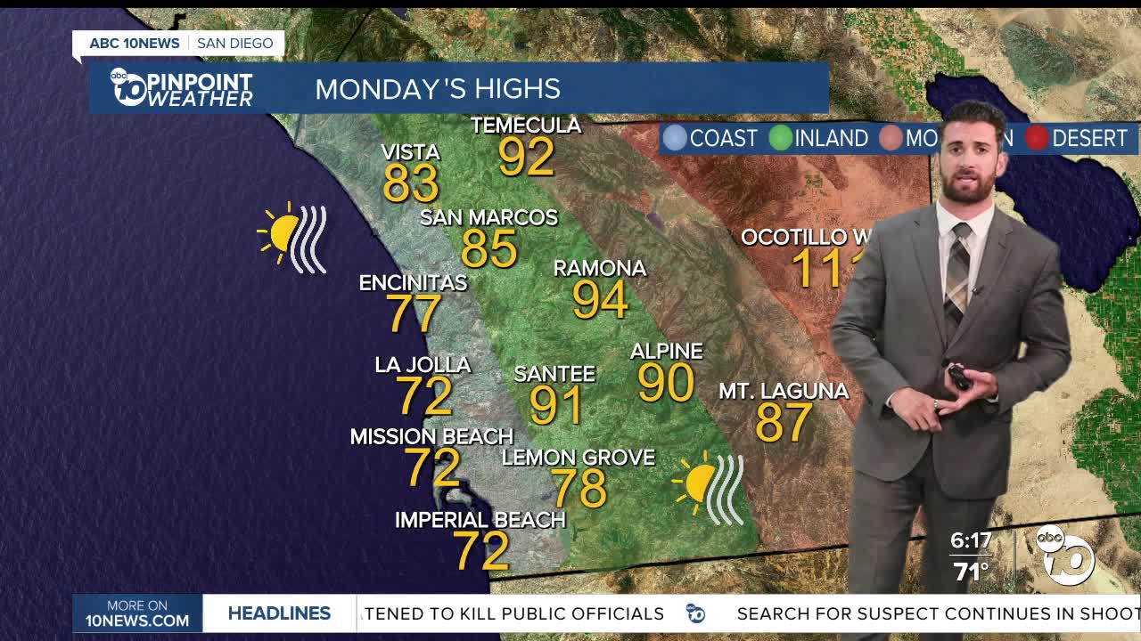
Monday's Highs:
Coast: 72-83°
Inland: 84-94°
Mountains: 87-96°
Deserts: 106-111°
Follow ABC 10News Weather Anchor Max Goldwasser on Instagram, Facebook and Twitter.


