

What was hurricane Kay has now fallen apart and is now a post-tropical cyclone moving away from San Diego. Moisture will continue to pour into San Diego through the weekend keeping the mugginess and occasional showers, heavy at times, and a few thunderstorms. Flooding was a major issue in the deserts today and continues as more rain falls this weekend. A Flood Watch remains in effect through Saturday night for the inland, mountain and desert areas.
The worst of the storm is over but not before dumping record daily rainfall today:
- Lake Cuyamaca 1.96"
- Campo .66"
- San Diego .59"
- Vista .37"
- Ramona .27"
- Escondido .16"
The deficit in San Diego for the water year total has dropped below 3" after today's rainfall which is wonderful as we are nearing the end of the water year which is September 30th. Even more beneficial to get this rain before Santa Ana season this fall.
Impressive rainfall in the mountains and deserts led to areas of flooding today. Totals as of 10pm Friday:
- Mt. Laguna 4.99"
- Julian 2.71"
- Lake Cuyamaca 2.00"
- Borrego Springs 1.50"
- La Mesa .48"
- Santee .49"
- Vista .40"
- Carlsbad .24"
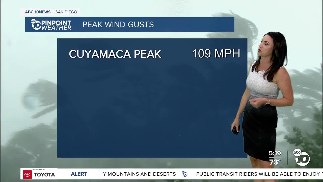
Strong and damaging winds were another big story. There have been multiple calls of downed trees and power lines because of high winds. It's advised you report any of this activity to your local authority. Peak wind gusts:
- Cuyamaca Peak 109mph
- Big Black Mountain 96mph
- Mt. Laguna 80mph
- Otay Mountain 81mph
- Jamul 79mph
- Pine Valley 75mph
- Julian 59mph
- Alpine 56mph
- Escondido 52mph
- Poway 40mph
It was an impressively warm start today with the high temperatures for the day set for most of the county before 6am! We had several 90s early this morning cooling off into the 80s and 70s by the afternoon. The heatwave is over with more comfortable temperatures into next week.
Elevated surf will accompany this storm with a Beach Hazards Statement in effect through 5pm Sunday for waves of 4 to 6 feet and strong rip currents as well as the threat for lightning. A Gale Warning is in effect through 9pm Saturday for winds of 35 to 45 knots and seas of 8 to 15 feet.
Slight chance for showers to linger into Monday and perhaps even Tuesday. Cooler and drier air moves in by mid to late next week as a trough of low-pressure dives south making it feel more comfortable.
Saturday's Highs:
Coast: 77-85°
Inland: 81-86°
Mountains: 65-78°
Deserts: 85-90°
Follow ABC 10News Meteorologist Megan Parry on Facebook at Megan Parry 10News, Instagram @mis_meg_wx and Twitter @10NewsParry
