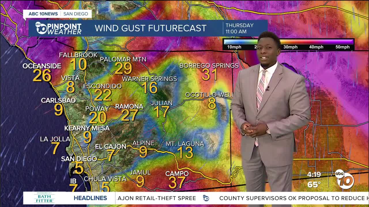


A low-pressure system will dive south towards us and sit parked to the east of San Diego tomorrow, bringing mild Santa Ana winds through Friday for the inland, mountain and desert communities. The mountains may see isolated thunderstorms Thursday to Sunday afternoons, with a slight chance of raindrops drifting inland or even hitting the coast Friday.
The track of this low-pressure system will determine how gusty the winds will get and the small chance of mountain showers. Above 5,000', we could see a little snow but are not expecting much, if any, accumulation.
Meanwhile, we'll have a gradual warm-up for the coast and valleys for the second half of the week.
High pressure builds this weekend, bringing temperatures near 80 degrees inland, well above our 30-year average!
By St. Patrick's Day, the county — even coastal areas—will be in the 70s, while the mountains will be near 60 and the deserts in the 80s.
Thursday’s Highs:
Coast: 64-73°
Inland: 61-69°
Mountains: 44-56°
Deserts: 61-69°
Follow ABC 10News Weather Anchor Moses Small on Instagram, Facebook and Twitter.
