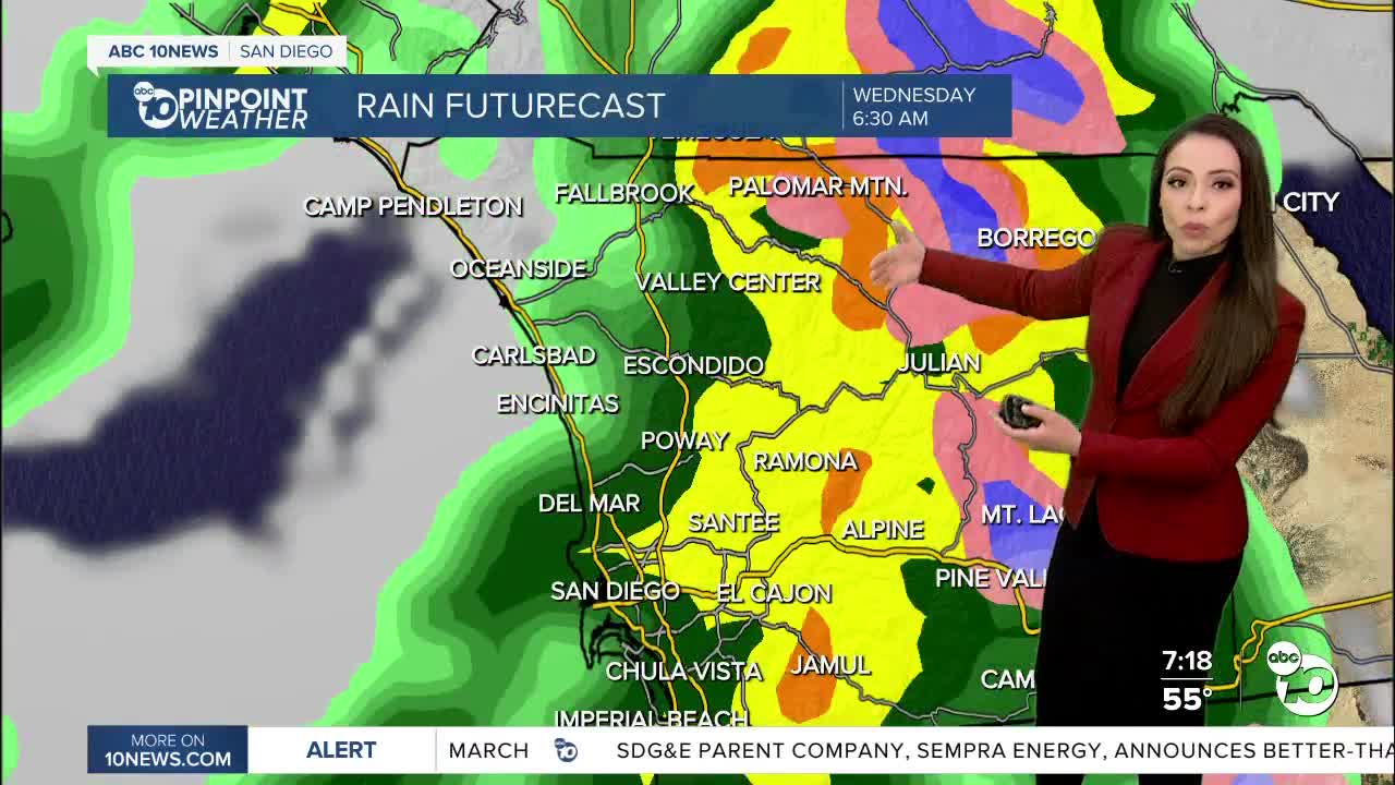
A stronger winter storm brings widespread rain, mountain snow, and strong winds tonight into the morning commute.
Rain will get heavier after 9pm becoming widespread and heavy. Snow early tomorrow morning will start at 5, 000 feet but dropping much lower by the afternoon. Snow levels could be as low as 2,500-3,000 feet by the afternoon and evening.
A Winter Storm Warning is in effect for the mountains until 10pm Wednesday. An additional 4 to 16" of snow will be possible with westerly gusts of 45 to 75mph. Travel through the mountains will be difficult if not impossible so be sure to carry chains and check round conditions before heading out.
The winds will also impact the rest of the county. A Wind Advisory is now in effect for the coastal areas and inland valleys until 6pm Wednesday. Gusts could reach up to 50 mph. Strong enough to bring down trees and power lines. By the far the strongest winds will be for our deserts, the winds here could reach 70-80 mph creating difficult driving conditions, especially for high profile vehicles with blowing dust. A High Wind Warning is effect until 10pm Wednesdsay.
The worst of the wet weather ends by mid to late morning tomorrow. Spotty showers will continue through Wednesday evening before drying out Thursday. Rainfall totals will average between .25 to 1.50" through Wednesday night.
Elevations:
Above 5,000' expect up to 16" of new snow: Mt. Laguna, Palomar Mountain, Lookout Mountain
Above 4,000' expect 3 to 6" of new snow: Julian, Ranchita, Tierra Del Sol
Above 3,000' expect 1 to 3" of new snow: Pine Valley, Pine Hills, Descanso, Warner Springs, Otay Mountain
Sunshine and dry conditions return starting Thursday with possible frost from our valleys to the coast. We'll see warmer conditions into the weekend, though still cooler than average. Thankfully, it will be sunny and pleasant for the Science Expo at Petco Park on Saturday; we hope to see you there.
A weak disturbance will pass by to the north of us early next week which will bring more clouds to the county, though it looks like the wet weather should miss us. Our next chance for a strong storm looks to arrive by the end of next week.
We've nearly picked up our annual average rainfall with 9.64" since October 1st at Lindbergh Field, taking our water year surplus to 2.58".
Wednesday's Highs:
Coast: 57-59°
Inland: 52-59°
Mountains: 33-48°
Deserts: 61-65°
Follow ABC 10News Meteorologist Angelica Campos on Facebook, Instagram @camposcrusher and Twitter @10NewsCampos


