

It was a lovely Valentine's Day with temperatures topping out in the 60s for most of the county. Marine layer clouds return tonight with patchy fog by tomorrow morning and minor warming through Saturday.
High pressure will keep the storm track to the north for several more days but these storms will enhance the onshore flow bringing marine layer clouds each night and morning and breezy conditions in the afternoons.
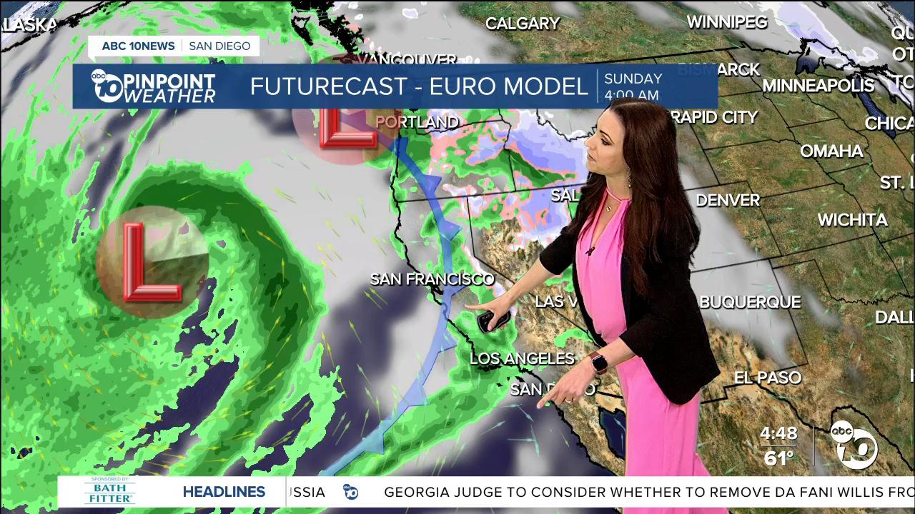
Two storms will bring rain and high-elevation snow across California this weekend into next week. The first one will mostly pass well to our north but a passing cold front will bring a very slight chance for a stray light shower on Sunday. A second storm will become a closed-low and stall offshore early next week, this may sound familiar as we just had a similar storm last week. What this means is that we expect widespread rain but there is high uncertainty on when that rain arrives and how much San Diego will get.
The highest totals will be north of San Diego county with the highest totals locally in the north county in areas like Oceanside, Fallbrook, Vista and Palomar Mountain. Rainfall totals are expected to be lighter than any recent storms that have hit the county.
As of today the best chance for widespread rain looks to arrive late Monday through Tuesday with scattered showers continuing through Wednesday. This is a relatively warm storm so no snow is expected in our mountains. Stay with the Pinpoint Weather Team for updates to this unique forecast.
Another storm will bring a chance of showers by the following weekend.
Thursday's Highs:
Coast: 61-65°
Inland: 64-70°
Mountains: 53-66°
Deserts: 71-74°
Follow ABC 10News Meteorologist Megan Parry on Facebook at Megan Parry 10News, Instagram @mis_meg_wx and Twitter @10NewsParry.
