

Happy Labor Day San Diego!
The heat and sun are here to stay for the holiday. And if you think things were hot over the weekend, they're about to get even hotter.
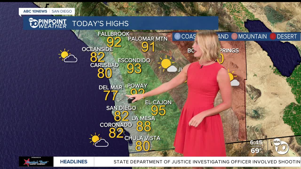
Today's Highs:
Coast: 76-90°
Inland: 90-98°
Mountains: 85-99°
Deserts: 103-109°
We're above average temperatures all across our region, today the coast will climb into the mid-70s to low 90s and the valleys in the low-to-upper 90s. Inland neighborhoods may be an area of a concern, they'll be under a heat advisory from 10 a.m. this morning through 6 p.m. Tuesday, so definitely stay indoors with the AC on in that area, or head to the beach to cool off!
If you head to the beach, make note the coast is still under a Beach Hazards Statement through this evening, during which there will be an elevated surf of 3-6 feet with sets up to 7 feet combined with strong rip currents. Reminder to swim near a lifeguard and watch your kids in the water!
The dry weather wont stick for long. Tonight is when monsoon moisture returns, that's when the mountains and deserts could see chances for thunderstorms return.
All four regions (coast, inland, mountains and deserts) have a chance at seeing that activity on Tuesday, with the greatest chances coming in the afternoon for east county communities.
That's the only day the coast could see showers and thunderstorms. Inland areas will see chances stick around on Wednesday as well.
The mountains and deserts have chances for showers and thunderstorms in the forecast every day from Tuesday through Saturday, before mostly sunny skies return on Sunday.
During that span, temperatures will cool down across the board.
Everyone will see daytime highs fall back to at-or-below normal by Thursday and will continue to keep dipping by a few degrees after that through Saturday.
Follow ABC 10News Reporter Olivia González-Britt on Facebook, Instagram, and X.
