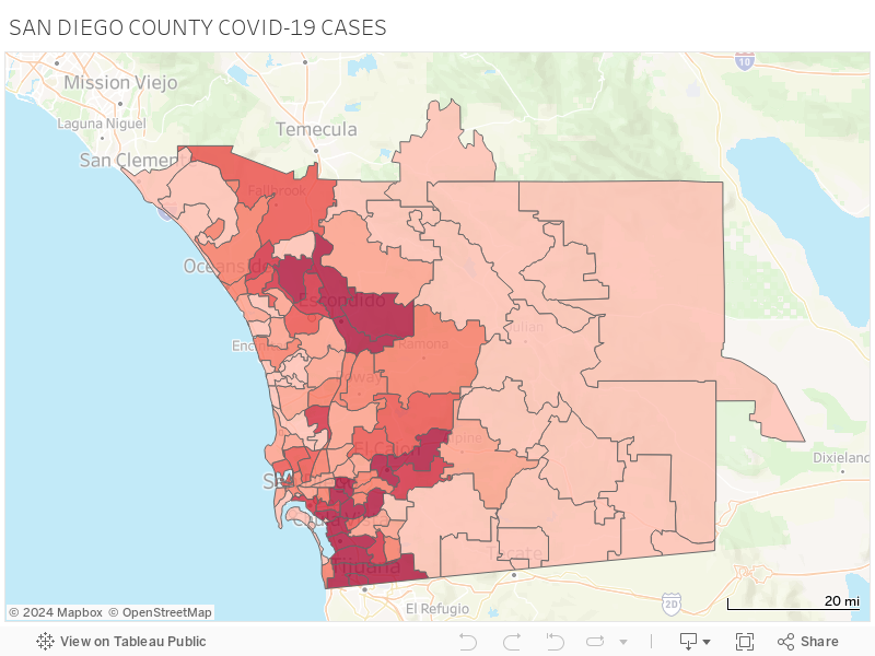
SAN DIEGO (KGTV) -- Interactive heat map shows hardest hit zip codes in San Diego County.
To interact with map, use any of the tools in the tool bar.
MORE: VIEW DEMOGRAPHIC DATA ON COVID-19 CASES IN SAN DIEGO COUNTY
You can draw a section of the map to pull data for that area using the lasso tool, use your mouse or touch pad to click inside any of the outlined territories, or hover to discover number of cases by zip code (see screen grab below).
TROUBLE SEEING THE MAP BELOW? Visit the map here